place

Haleets

ArchaeoastronomyBainbridge Island, WashingtonCoast Salish artGlacial erratics of Washington (state)Individual rocks
Kitsap County, Washington geography stubsPetroglyphs in Washington (state)
Haleets petroglyph rock

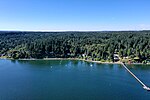
Haleets (also called Figurehead Rock) is a sandstone glacial erratic boulder with inscribed petroglyphs on Bainbridge Island, Washington. The Native American Suquamish Tribe claims the rock, on a public beach at Agate Point on the shore of Agate Passage, as part of their heritage. The exact date the petroglyphs were carved is unknown but is estimated to be around 1000 BCE to 400 or 500 CE, the latest date being when labrets (worn by one of the petroglyph figures) were no longer used by Coast Salish peoples.Haleets is the Coast Salish name of the rock, also transcribed as Halelos, Xalelos and Xalilc, meaning "marked face". It is known in English as Figurehead Rock. Its purpose is unknown but the Suquamish Museum curator and archivist Charlie Sigo has stated that it may have been a boundary marker. An amateur astronomer has proposed a theory that it has a calendrical function (see Archaeoastronomy). The rock is 5 feet (1.5 m) tall and 7 feet (2.1 m) long. It sits about 100 feet (30 m) offshore, and has been marked with chiseled and drilled Coast Survey features since 1856, and a bronze geodetic mark was placed on it in 1934. Some sources say that the rock is one of three prominent Salish Sea petroglyphs that were always on the shoreline, but tectonic activity around the Seattle Fault may have put Haleets in the intertidal zone.

Excerpt from the Wikipedia article Haleets (License: CC BY-SA 3.0, Authors, Images).

Haleets
Northeast North Street,

Geographical coordinates (GPS) Address External links Nearby Places
placeShow on map

Wikipedia: HaleetsContinue reading on Wikipedia

Geographical coordinates (GPS)

Latitude Longitude
N 47.718638888889 ° E -122.54447222222 °
placeShow on map

Address

Haleets (Figurehead Rock)

Northeast North Street
98392
Washington, United States
mapOpen on Google Maps

linkWikiData (Q19867453)
linkOpenStreetMap (10774593445)

Haleets petroglyph rock
Share experience

Nearby Places

Port Madison

Port Madison, sometimes called Port Madison Bay, is a deep water bay located on the west shore of Puget Sound in western Washington. It is bounded on the north by Indianola, on the west by Suquamish, and on the south by Bainbridge Island. Port Madison connects to Bainbridge Island via the Agate Pass Bridge to the southwest. Two small bays open off Port Madison: Miller Bay to the northwest, and another small bay to the south which, confusingly, is also called Port Madison Bay (or, locally, as the "Inner Harbor"). The inner harbor, which indents into Bainbridge Island is where the Port Madison Yacht Club and a Seattle Yacht Club outstation are located. The Port Madison Indian Reservation is located on the west and north shores of Port Madison. According to various sources, the native name of the bay was either Tu-che-kup or Noo-sohk-um. On Nov. 8 1824, John Work of the Hudson's Bay Company, while looking for potential sites for a trading post, recorded it as Soquamis Bay - a variation on the name of the Suquamish tribe which made its home on the western shore. The Wilkes Expedition surveyed the bay on May 10, 1841 and named it for James Madison, the 4th president of the United States. George A. Meigs built a lumber mill on the Bainbridge Island shore of the bay in 1854, and Port Madison was soon a booming mill town. The town of Port Madison became Kitsap County's first county seat, but after the economic depression of the 1890s closed the mill, the seat was relocated and Port Madison became a ghost town. Today, Port Madison is a residential area and a popular destination for boaters.