place

Agate Pass

Bainbridge Island, WashingtonKitsap County, Washington geography stubsLandforms of Puget SoundStraits of Kitsap County, WashingtonStraits of Washington (state)
Agate pass2
Agate pass2

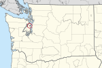
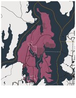
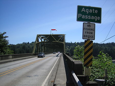
Agate Pass or Agate Passage is a high-current tidal strait in Puget Sound connecting Port Madison and mainland Kitsap County in the US state of Washington. It lies between Bainbridge Island and the mainland of the Kitsap Peninsula near Suquamish. It leads south towards Bremerton, extending about one mile (1.6 km) in a straight, southwesterly direction. The depth is about 20 feet (6.1 m). The shores are wooded and fairly steep. The shoreline is mostly rocky and fringed with kelp to Point Bolin. The tidal currents have velocities up to six knots; the flood tide sets southwesterly, and the ebb tide northeasterly. The traditional winter village of the Suquamish people was located on Agate Pass. It was the site of Old Man House, the largest longhouse on Puget Sound, and is the location of Haleets, a petroglyph. Agate Pass was unknown to non-native people until it was discovered by the Wilkes Expedition in 1841. Before then, Europeans thought Bainbridge Island was a peninsula. It was named by U.S. Navy Lt. Charles Wilkes in honor of one of the members of the expedition, Alfred Thomas Agate. In 1950, a fixed highway bridge, the Agate Pass Bridge was built, connecting Bainbridge Island to the Kitsap Peninsula for the first time. The bridge is listed on the National Register of Historic Places.

Excerpt from the Wikipedia article Agate Pass (License: CC BY-SA 3.0, Authors, Images).

Agate Pass
Agatewood Road Northeast,

Geographical coordinates (GPS) Address Nearby Places
placeShow on map

Wikipedia: Agate PassContinue reading on Wikipedia

Geographical coordinates (GPS)

Latitude Longitude
N 47.7159294 ° E -122.5609725 °
placeShow on map

Address

Agatewood Road Northeast
98392
Washington, United States
mapOpen on Google Maps

Agate pass2
Agate pass2
Share experience

Nearby Places

Port Madison

Port Madison, sometimes called Port Madison Bay, is a deep water bay located on the west shore of Puget Sound in western Washington. It is bounded on the north by Indianola, on the west by Suquamish, and on the south by Bainbridge Island. Port Madison connects to Bainbridge Island via the Agate Pass Bridge to the southwest. Two small bays open off Port Madison: Miller Bay to the northwest, and another small bay to the south which, confusingly, is also called Port Madison Bay (or, locally, as the "Inner Harbor"). The inner harbor, which indents into Bainbridge Island is where the Port Madison Yacht Club and a Seattle Yacht Club outstation are located. The Port Madison Indian Reservation is located on the west and north shores of Port Madison. According to various sources, the native name of the bay was either Tu-che-kup or Noo-sohk-um. On Nov. 8 1824, John Work of the Hudson's Bay Company, while looking for potential sites for a trading post, recorded it as Soquamis Bay - a variation on the name of the Suquamish tribe which made its home on the western shore. The Wilkes Expedition surveyed the bay on May 10, 1841 and named it for James Madison, the 4th president of the United States. George A. Meigs built a lumber mill on the Bainbridge Island shore of the bay in 1854, and Port Madison was soon a booming mill town. The town of Port Madison became Kitsap County's first county seat, but after the economic depression of the 1890s closed the mill, the seat was relocated and Port Madison became a ghost town. Today, Port Madison is a residential area and a popular destination for boaters.