place

Frog Rock (Bainbridge Island, Washington)

1971 worksBainbridge Island, WashingtonGlacial erratics of Washington (state)Individual rocksRoadside attractions in Washington (state)
Bainbridge Island Frog Rock

Frog Rock is a glacial erratic on Bainbridge Island, Washington. The frog shape is made of two stacked granite boulders, painted by a pair of local residents to resemble a frog on June 6, 1971, The pair of boulders were reportedly once a single boulder which was dynamited in the 1950s or earlier, in order to remove it from a road right-of-way. After the dynamiting, the rock was known as "Split Rock".The rock is locally famous, known to be a humorous historic marker, and a notable visitor attraction. It is used by bicyclists as a regrouping point.A local "resiliency forum" is named for it.

Excerpt from the Wikipedia article Frog Rock (Bainbridge Island, Washington) (License: CC BY-SA 3.0, Authors, Images).

Frog Rock (Bainbridge Island, Washington)
Phelps Road Northeast,

Geographical coordinates (GPS) Address Nearby Places
placeShow on map

Wikipedia: Frog Rock (Bainbridge Island, Washington)Continue reading on Wikipedia

Geographical coordinates (GPS)

Latitude Longitude
N 47.69612 ° E -122.52347 °
placeShow on map

Address

Phelps Road Northeast 14623
98110
Washington, United States
mapOpen on Google Maps

Bainbridge Island Frog Rock
Share experience

Nearby Places

Port Madison

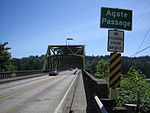
Port Madison, sometimes called Port Madison Bay, is a deep water bay located on the west shore of Puget Sound in western Washington. It is bounded on the north by Indianola, on the west by Suquamish, and on the south by Bainbridge Island. Port Madison connects to Bainbridge Island via the Agate Pass Bridge to the southwest. Two small bays open off Port Madison: Miller Bay to the northwest, and another small bay to the south which, confusingly, is also called Port Madison Bay (or, locally, as the "Inner Harbor"). The inner harbor, which indents into Bainbridge Island is where the Port Madison Yacht Club and a Seattle Yacht Club outstation are located. The Port Madison Indian Reservation is located on the west and north shores of Port Madison. According to various sources, the native name of the bay was either Tu-che-kup or Noo-sohk-um. On Nov. 8 1824, John Work of the Hudson's Bay Company, while looking for potential sites for a trading post, recorded it as Soquamis Bay - a variation on the name of the Suquamish tribe which made its home on the western shore. The Wilkes Expedition surveyed the bay on May 10, 1841 and named it for James Madison, the 4th president of the United States. George A. Meigs built a lumber mill on the Bainbridge Island shore of the bay in 1854, and Port Madison was soon a booming mill town. The town of Port Madison became Kitsap County's first county seat, but after the economic depression of the 1890s closed the mill, the seat was relocated and Port Madison became a ghost town. Today, Port Madison is a residential area and a popular destination for boaters.