place

Bloedel Reserve

1988 establishments in Washington (state)Bainbridge Island, WashingtonBotanical gardens in Washington (state)Gardens in Washington (state)Japanese-American culture in Washington (state)
Japanese gardens in the United StatesKitsap County, Washington geography stubsParks in Kitsap County, WashingtonUnited States garden stubsUniversity of Washington organizationsUse mdy dates from August 2020
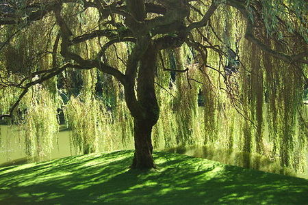
Bloedel Reserve Willow Tree

The Bloedel Reserve is a 150-acre (0.6 km2) forest garden on Bainbridge Island, Washington, United States. It was created by Virginia and Prentice Bloedel, the vice-chairman of the lumber company MacMillan Bloedel Limited, under the influence of the conservation movement and Asian philosophy. The couple wished to capture the essence of the Japanese garden—the qualities of naturalness, subtlety, reverence, tranquility—and construct a Western expression of it. Although the Reserve includes a traditional Japanese garden, the Bloedels' approach for the rest of the property stands in contrast to that of 'Japanese gardens' which achieve their effects through the use of ornament. The Bloedel Reserve has both natural and highly landscaped lakes, immaculate lawns, woods, a stone garden (formerly the swimming pool where poet Theodore Roethke drowned in 1963), a moss garden, a rhododendron glen, and a reflection garden designed with the assistance of landscape architects Richard Haag, Thomas Church, Kazimir Wall, and Danielle Stern. The Bloedels' French Chateau-style home, including many original furnishings, is preserved as a visitor center.The Reserve opened to the public in 1988 as a family run foundation and registered as a 501(c)3 public charity in 2010. It is open year-round.

Excerpt from the Wikipedia article Bloedel Reserve (License: CC BY-SA 3.0, Authors, Images).

Bloedel Reserve
Agate Point Road Northeast,

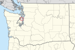
Geographical coordinates (GPS) Address Nearby Places
placeShow on map

Wikipedia: Bloedel ReserveContinue reading on Wikipedia

Geographical coordinates (GPS)

Latitude Longitude
N 47.708333333333 ° E -122.54777777778 °
placeShow on map

Address

Agate Point Road Northeast 16110
98110
Washington, United States
mapOpen on Google Maps

Bloedel Reserve Willow Tree
Share experience

Nearby Places

Port Madison

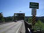
Port Madison, sometimes called Port Madison Bay, is a deep water bay located on the west shore of Puget Sound in western Washington. It is bounded on the north by Indianola, on the west by Suquamish, and on the south by Bainbridge Island. Port Madison connects to Bainbridge Island via the Agate Pass Bridge to the southwest. Two small bays open off Port Madison: Miller Bay to the northwest, and another small bay to the south which, confusingly, is also called Port Madison Bay (or, locally, as the "Inner Harbor"). The inner harbor, which indents into Bainbridge Island is where the Port Madison Yacht Club and a Seattle Yacht Club outstation are located. The Port Madison Indian Reservation is located on the west and north shores of Port Madison. According to various sources, the native name of the bay was either Tu-che-kup or Noo-sohk-um. On Nov. 8 1824, John Work of the Hudson's Bay Company, while looking for potential sites for a trading post, recorded it as Soquamis Bay - a variation on the name of the Suquamish tribe which made its home on the western shore. The Wilkes Expedition surveyed the bay on May 10, 1841 and named it for James Madison, the 4th president of the United States. George A. Meigs built a lumber mill on the Bainbridge Island shore of the bay in 1854, and Port Madison was soon a booming mill town. The town of Port Madison became Kitsap County's first county seat, but after the economic depression of the 1890s closed the mill, the seat was relocated and Port Madison became a ghost town. Today, Port Madison is a residential area and a popular destination for boaters.