Eeserveen
Borger-OdoornDrenthe geography stubsPopulated places in Drenthe

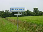
Eeserveen is a village in the Dutch province of Drenthe. It is a part of the municipality of Borger-Odoorn, and lies about 14 km northwest of Emmen. The village was first mentioned between 1851 and 1855 as Eesterveen, and means "peat excavation settlement belonging to Ees". The excavation of the peat started around 1870. It used to consists mainly of sod houses which were later replaced by stone houses.Until 1997, the village was split between Borger and Odoorn. In 1998, it became part of the municipality of Borger-Odoorn.
Excerpt from the Wikipedia article Eeserveen (License: CC BY-SA 3.0, Authors, Images).Eeserveen
Brammershoopstraat, Eeserveen
Geographical coordinates (GPS) Address Nearby Places Show on map
Geographical coordinates (GPS)
| Latitude | Longitude |
|---|---|
| N 52.867222222222 ° | E 6.7638888888889 ° |
Address
Brammershoopstraat
Brammershoopstraat
7858 TE Eeserveen
Drenthe, Netherlands
Open on Google Maps


