Ees, Drenthe
Borger-OdoornDrenthe geography stubsPopulated places in Drenthe

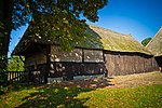
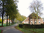
Ees is a village in the Dutch province of Drenthe. It is a part of the municipality of Borger-Odoorn, and lies about 17 km north of Emmen. The village was first mentioned in 1263 as de Ese, and means "farmland around a village".Situated close to the town of Borger, Ees retains a provincial charm that is characterised by pleasant homes and a large expanse of woodland to the South East. A network of bike paths and horse trails (ruiterpads) throughout the woods provides for some peaceful treks.
Excerpt from the Wikipedia article Ees, Drenthe (License: CC BY-SA 3.0, Authors, Images).Ees, Drenthe
Holtslagenweg, Eesergroen
Geographical coordinates (GPS) Address Nearby Places Show on map
Geographical coordinates (GPS)
| Latitude | Longitude |
|---|---|
| N 52.9 ° | E 6.8 ° |
Address
Holtslagenweg
Holtslagenweg
9537 TG Eesergroen
Drenthe, Netherlands
Open on Google Maps


