Elsted and Treyford
Chichester DistrictVillages in West SussexWest Sussex geography stubs

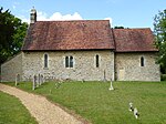
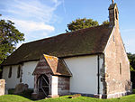
Elsted and Treyford is a civil parish in the Chichester district of West Sussex, west of Midhurst. It contains the settlements of Elsted, Elsted Marsh, Treyford, Didling and Hooksway. The parish contains two churches, St Paul in Elsted and St Andrew, known as the Shepherds' Church, in the hamlet of Didling. It also contains the site of Treyford church. Hooksway has a 16th-century pub, the Royal Oak.In the 2001 census there were 114 households with a total population of 253 of whom 116 were economically active. At the 2011 Census the population was 246.The Devil's Jumps, Treyford, and Beacon Hill are nearby.
Excerpt from the Wikipedia article Elsted and Treyford (License: CC BY-SA 3.0, Authors, Images).Elsted and Treyford
Elsted Road, Chichester Elsted and Treyford
Geographical coordinates (GPS) Address Nearby Places Show on map
Geographical coordinates (GPS)
| Latitude | Longitude |
|---|---|
| N 50.96998 ° | E -0.83917 ° |
Address
Elsted Road
Elsted Road
GU29 0JY Chichester, Elsted and Treyford
England, United Kingdom
Open on Google Maps
