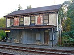
Roxborough, Philadelphia
Neighborhoods in PhiladelphiaRoxborough, Philadelphia

Roxborough is a neighborhood in the Northwest section of the city of Philadelphia, Pennsylvania. It is bordered to the southwest, along the Schuylkill River, by the neighborhood of Manayunk, along the northeast by the Wissahickon Creek section of Fairmount Park, and to the southeast by the neighborhood of East Falls. Beyond Roxborough to the northwest is Montgomery County. Roxborough's ZIP code is 19128. Most of Roxborough is in Philadelphia's 21st Ward.
Excerpt from the Wikipedia article Roxborough, Philadelphia (License: CC BY-SA 3.0, Authors, Images).Roxborough, Philadelphia
Eva Street, Philadelphia
Geographical coordinates (GPS) Address Nearby Places Show on map
Geographical coordinates (GPS)
| Latitude | Longitude |
|---|---|
| N 40.054 ° | E -75.242 ° |
Address
Eva Street 8158
19128 Philadelphia
Pennsylvania, United States
Open on Google Maps

