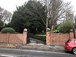
Moor Pool
Areas of Birmingham, West MidlandsConservation areas in EnglandEngvarB from February 2018Garden suburbsGeographic coordinate lists ... and 4 more
HarborneLists of coordinatesPopulated places established in 1907West Midlands (county) geography stubs

Moor Pool (or Moorpool) is a 22.32 hectares (55.2 acres) garden suburb within the ward of Harborne, Birmingham, England. It was designated a Conservation Area in July 1970, which was raised by an Article 4(2) direction order in 2006. A Conservation Area Character Appraisal and Management Plan was adopted in March 2012.
Excerpt from the Wikipedia article Moor Pool (License: CC BY-SA 3.0, Authors, Images).Moor Pool
Ravenhurst Road, Birmingham
Geographical coordinates (GPS) Address Nearby Places Show on map
Geographical coordinates (GPS)
| Latitude | Longitude |
|---|---|
| N 52.4627 ° | E -1.9542 ° |
Address
Ravenhurst Road
Ravenhurst Road
B17 9SE Birmingham
England, United Kingdom
Open on Google Maps


