Lierskogen
Buskerud geography stubsVillages in Buskerud

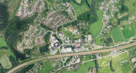
Lierskogen is the easternmost village of Lier municipality in Viken county, Norway. Lierskogen makes up the eastern part of Lier together with the nearby village of Tranby. It borders Asker to the east and Drammen to the west. One of the busiest highways in Norway, European route E18 runs straight through the agricultural landscape of Lierskogen.
Excerpt from the Wikipedia article Lierskogen (License: CC BY-SA 3.0, Authors, Images).Lierskogen
Grøstadveien, Lier
Geographical coordinates (GPS) Address Nearby Places Show on map
Geographical coordinates (GPS)
| Latitude | Longitude |
|---|---|
| N 59.815833333333 ° | E 10.306111111111 ° |
Address
Grøstadveien
Grøstadveien
3409 Lier
Norway
Open on Google Maps


