place

Mount Mitchill

Atlantic Highlands, New JerseyLandforms of Monmouth County, New JerseyMonmouth County, New Jersey geography stubsMountains of New Jersey
NavesinkHighlands MtMitchillOverlook

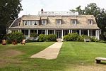
Mount Mitchill in Atlantic Highlands, Monmouth County, New Jersey, United States, at 266 feet (81 meters), is the highest headland of the United States east coast south of Maine. It has a panoramic view of Raritan Bay, New York City and Sandy Hook and is near the Twin Lights Lighthouse in Highlands. It is the location of the Monmouth County 9-11 Memorial. It was named after Samuel Latham Mitchill, who determined the height of the hill.

Excerpt from the Wikipedia article Mount Mitchill (License: CC BY-SA 3.0, Authors, Images).

Mount Mitchill
East Highland Avenue,

Geographical coordinates (GPS) Address Nearby Places
placeShow on map

Wikipedia: Mount MitchillContinue reading on Wikipedia

Geographical coordinates (GPS)

Latitude Longitude
N 40.4068 ° E -74.0065 °
placeShow on map

Address

East Highland Avenue 498
07716
New Jersey, United States
mapOpen on Google Maps

NavesinkHighlands MtMitchillOverlook
Share experience

Nearby Places

Highlands, New Jersey

See also New York–New Jersey Highlands for the northwestern part of the state.Highlands is a borough in Monmouth County, New Jersey, United States. As of the 2010 United States Census, its population was 5,005, a decline of 92 (-1.8%) from the 2000 Census, which had seen an increase of 248 (+5.1%) from the 1990 Census. The eastern part of the town is on a high bluff that overlooks Sandy Hook and the Atlantic Ocean, from which the borough derives its name. Atop this bluff are the Navesink Twin Lights. Highlands was incorporated as a borough by an act of the New Jersey Legislature on March 22, 1900, from parts of Middletown Township. Additional parts of Middletown Township were annexed in 1914.Highlands is part of the Bayshore Regional Strategic Plan, an effort by nine municipalities in northern Monmouth County to reinvigorate the area's economy by emphasizing the traditional downtowns, residential neighborhoods, maritime history, and the natural environment of the Raritan Bayshore coastline.On October 29, 2012, Hurricane Sandy struck the eastern seaboard of the United States, making landfall just north of Atlantic City. The borough was heavily damaged when a storm surge of nearly 10 feet (3.0 m) swept in from the bay beginning October 28. Most homes and businesses, including the Bahrs Landing and Lusty Lobster fishery were either damaged or totally destroyed. The borough lost several police cars and its fire station was destroyed.