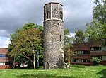
Golden Triangle (Norwich)

The Golden Triangle is a wedge-shaped area within the south western suburbs of Norwich, United Kingdom. The base of the Triangle is at the Colman Road stretch of the outer ring road, which is one mile south west of the city's inner ring, with the other two sides – Earlham Road and Newmarket Road – pointing into the city centre. The Unthank Road runs down the middle, forming the backbone and main shopping area of the Triangle. The Golden Triangle's terraces house professionals, families and many students from the nearby University of East Anglia; its friendly atmosphere has resulted in the Golden Triangle being dubbed the Norwich version of London's Notting Hill.
Excerpt from the Wikipedia article Golden Triangle (Norwich) (License: CC BY-SA 3.0, Authors, Images).Golden Triangle (Norwich)
Unthank Road, Norwich Heigham Grove
Geographical coordinates (GPS) Address Nearby Places Show on map
Geographical coordinates (GPS)
| Latitude | Longitude |
|---|---|
| N 52.6275 ° | E 1.2817 ° |
Address
Heathcote Residential Home
Unthank Road 19-23
NR2 2PA Norwich, Heigham Grove
England, United Kingdom
Open on Google Maps


