Harrow, London

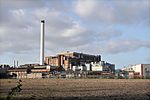
Harrow () is a large town in Greater London, England, and serves as the principal settlement of the London Borough of Harrow. Lying about 9.5 miles (15.3 km) north-west of Charing Cross and 5.4 miles (8.7 km) south of Watford, the entire town including its localities had a population of 149,246 as of the 2011 census, whereas the wider borough (which also contains Pinner and Stanmore) had a population of 250,149. The historic centre of Harrow was atop the 408 feet (124 m) Harrow Hill. The modern town of Harrow grew out at the foot of the settlement, in what was historically called Greenhill. With the arrival of the Metropolitan Railway in the 19th century, the centre of Harrow moved to Greenhill and it grew as the unofficial "capital" of the Metroland suburbia in the early 20th century; Harrow-on-the-Hill station is on one of the railway corridors between London and the Chilterns. Meanwhile, Harrow & Wealdstone station is on the West Coast Main Line and is the eighth oldest railway station, having opened in 1837 one and a half mile north of the hill. Workers were drawn to the area by the opening of several factories in Wealdstone; Harrow was the base of the large Kodak factory, used for the manufacture of photographic materials and R&D, which was in operation for more than a century. Historically in the hundred of Gore, county of Middlesex, the merged Harrow was a municipal borough before it became a part of Greater London in 1965. Today, the historic area is distinguished as Harrow on the Hill and is a conservation area with listed buildings of Georgian architecture and home to Harrow School, one of the seven major boys' boarding schools in England as defined by the Public Schools Act 1868. The modern-day town meanwhile is an established commercial centre of outer north-west London and houses a campus of the University of Westminster.
Excerpt from the Wikipedia article Harrow, London (License: CC BY-SA 3.0, Authors, Images).Harrow, London
Hindes Road, London Harrow on the Hill (London Borough of Harrow)
Geographical coordinates (GPS) Address Nearby Places Show on map
Geographical coordinates (GPS)
| Latitude | Longitude |
|---|---|
| N 51.5836 ° | E -0.3464 ° |
Address
Harrow Bowls Club
Hindes Road
HA1 1RS London, Harrow on the Hill (London Borough of Harrow)
England, United Kingdom
Open on Google Maps


