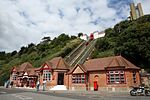
Folkestone Harbour railway station

Folkestone Harbour station was one of four railway stations in Folkestone, Kent. It served Folkestone Harbour with connecting boat train services across the English Channel to Calais and Boulogne. The station was opened by the South Eastern Railway (SER) in 1849 as part of a project to redevelop the harbour and connect it to the wider railway network. The local geography prevented direct access from the South Eastern main line, so a 1-mile (1.6 km) 1-in-32 branch line was built from Folkestone Junction, which crossed the harbour on a viaduct, reaching the station at the pier. Originally designed for freight, the line also became popular with continental passenger services. The station was redeveloped in the early 20th century and it was an important destination for soldiers during World War I. The opening of the Channel Tunnel in 1994 made Folkestone Harbour uncompetitive, and the station began to decline, with regular passenger services ending in 2001. After this, the line saw occasional steam rail tours and Venice-Simplon Orient Express (VSOE) trains, with the final service running in 2009. The station was formally closed in 2014, and redeveloped into a market and restaurants along with the rest of the harbour complex.
Excerpt from the Wikipedia article Folkestone Harbour railway station (License: CC BY-SA 3.0, Authors, Images).Folkestone Harbour railway station
Harbour Approach Road, Folkestone and Hythe District Foord
Geographical coordinates (GPS) Address Nearby Places Show on map
Geographical coordinates (GPS)
| Latitude | Longitude |
|---|---|
| N 51.0781 ° | E 1.1874 ° |
Address
Rug People
Harbour Approach Road
CT20 1QN Folkestone and Hythe District, Foord
England, United Kingdom
Open on Google Maps


