Canning Town
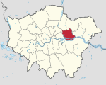
Canning Town is a district in the London Borough of Newham, East London. The district is located to the north of the Royal Victoria Dock, and has been described as the "Child of the Victoria Docks" as the timing and nature of its urbanisation was largely due to the creation of the dock. The area was part of the ancient parish of West Ham, in the hundred of Becontree, and part of the historic county of Essex. It forms part of the London E16 postcode district. The area, the location of the Rathbone Market, is undergoing significant regeneration as of 2012. According to Newham Council: "The Canning Town and Custom House Regeneration Programme includes the building of up to 10,000 new homes, creation of thousands of new jobs and two improved town centres. This £3.7 billion project aims to transform the area physically, socially and economically."
Excerpt from the Wikipedia article Canning Town (License: CC BY-SA 3.0, Authors).Canning Town
Freemasons Road, London Canning Town (London Borough of Newham)
Geographical coordinates (GPS) Address Nearby Places Show on map
Geographical coordinates (GPS)
| Latitude | Longitude |
|---|---|
| N 51.515 ° | E 0.026 ° |
Address
Freemasons Road
E16 3SH London, Canning Town (London Borough of Newham)
England, United Kingdom
Open on Google Maps


