Le Taillefer
Isère geography stubsMountains of IsèreMountains of the Alps

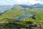
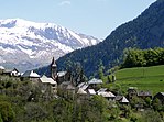
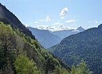
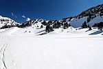
Le Taillefer is a mountain in the Dauphiné Alps, culminating at a height of 2,857 m (9,373 ft). It is located south-east of Grenoble, and is the highest mountain in the Taillefer Massif.
Excerpt from the Wikipedia article Le Taillefer (License: CC BY-SA 3.0, Authors, Images).Le Taillefer
Vers La Barrière, Livet-et-Gavet
Geographical coordinates (GPS) Address Nearby Places Show on map
Geographical coordinates (GPS)
| Latitude | Longitude |
|---|---|
| N 45.039444444444 ° | E 5.9241666666667 ° |
Address
Statue de Saint-Éloi
Vers La Barrière
38220 Livet-et-Gavet
Auvergne-Rhône-Alpes, France
Open on Google Maps


