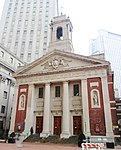
place

New York City Landmarks Preservation Commission

1965 establishments in New York CityGovernment of New York CityLocally designated landmarks in the United StatesNew York City Landmarks Preservation CommissionUse mdy dates from January 2022
NYP LOC4
NYP LOC4

The New York City Landmarks Preservation Commission (LPC) is the New York City agency charged with administering the city's Landmarks Preservation Law. The LPC is responsible for protecting New York City's architecturally, historically, and culturally significant buildings and sites by granting them landmark or historic district status, and regulating them after designation. It is the largest municipal preservation agency in the nation. As of July 1, 2020, the LPC has designated more than 37,000 landmark properties in all five boroughs. Most of these are concentrated in historic districts, although there are over a thousand individual landmarks, as well as numerous interior and scenic landmarks. Mayor Robert F. Wagner Jr. first organized a preservation committee in 1961, and the following year, created the LPC. The LPC's power was greatly strengthened after the Landmarks Law was passed in April 1965, one and a half years after the destruction of Pennsylvania Station. The LPC has been involved in several prominent preservation decisions, including that of Grand Central Terminal. By 1990, the LPC was cited by David Dinkins as having preserved New York City's municipal identity and enhanced the market perception of a number of neighborhoods. The LPC is governed by eleven commissioners. The Landmarks Preservation Law stipulates that a building must be at least thirty years old before the LPC can declare it a landmark.

Excerpt from the Wikipedia article New York City Landmarks Preservation Commission (License: CC BY-SA 3.0, Authors, Images).

New York City Landmarks Preservation Commission
St. Andrews Plaza, New York Manhattan

Geographical coordinates (GPS) Address Nearby Places
placeShow on map

Wikipedia: New York City Landmarks Preservation CommissionContinue reading on Wikipedia

Geographical coordinates (GPS)

Latitude Longitude
N 40.713055555556 ° E -74.003611111111 °
placeShow on map

Address

Chambers Street (J,Z)

St. Andrews Plaza
10278 New York, Manhattan
New York, United States
mapOpen on Google Maps

NYP LOC4
NYP LOC4
Share experience

Nearby Places

Manhattan Municipal Building

The David N. Dinkins Municipal Building (originally the Municipal Building and later known as the Manhattan Municipal Building) is a 40-story, 580-foot (180 m) building at 1 Centre Street, east of Chambers Street, in the Civic Center neighborhood of Manhattan in New York City The structure was built to accommodate increased governmental space demands after the 1898 consolidation of the city's five boroughs. Construction began in 1909 and continued through 1914 at a total cost of $12 million (equivalent to $232,730,000 in 2020). Designed by McKim, Mead & White, the Manhattan Municipal Building was among the last buildings erected as part of the City Beautiful movement in New York. Its architectural style has been characterized as Roman Imperial, Italian Renaissance, French Renaissance, or Beaux-Arts. The Municipal Building is one of the largest governmental buildings in the world, with about 1 million square feet (93,000 m2) of office space. The base incorporates a subway station, while the top includes the gilded Civic Fame statue. The Municipal Building was erected after three previous competitions to build a single municipal building for New York City's government had failed. In 1907, the city's Commissioner of Bridges held a competition to design the building in conjunction with a subway and trolley terminal at the Brooklyn Bridge, of which McKim, Mead & White's plan was selected. The first offices in the Municipal Building were occupied by 1913. In later years, it received several renovations, including elevator replacements in the 1930s and restorations in the mid-1970s and the late 1980s. The New York City Landmarks Preservation Commission designated the building a landmark in 1966, and it was listed on the National Register of Historic Places in 1972.

Surrogate's Courthouse

The Surrogate's Courthouse (also the Hall of Records and 31 Chambers Street) is a historic building at the northwest corner of Chambers and Centre Streets in the Civic Center of Manhattan in New York City. Completed in 1907, it was designed in the Beaux Arts style. John Rochester Thomas created the original plans while Arthur J. Horgan and Vincent J. Slattery oversaw the building's completion. The building faces City Hall Park and the Tweed Courthouse to the south and the Manhattan Municipal Building to the east. The Surrogate's Courthouse is a seven-story, steel-framed structure with a granite facade and elaborate marble interiors. The fireproof frame was designed to safely accommodate the city's paper records. The exterior is decorated with 54 sculptures by Philip Martiny and Henry Kirke Bush-Brown, as well as a three-story Corinthian order colonnade on Chambers and Reade Streets. The basement houses the New York City Municipal Archives. The fifth floor contains the New York Surrogate's Court for New York County, which handles probate and estate proceedings for the New York State Unified Court System. The Hall of Records building had been planned since the late 19th century to replace an outdated building in City Hall Park; plans for the current building were approved in 1897. Construction took place between 1899 and 1907, having been subject to several delays because of controversies over funding, sculptures, and Horgan and Slattery's involvement after Thomas's death in 1901. Renamed the Surrogate's Courthouse in 1962, the building has undergone few alterations over the years. The Surrogate's Courthouse is listed on the National Register of Historic Places as a National Historic Landmark, and its facade and interior are both New York City designated landmarks.

Brooklyn Bridge–City Hall/Chambers Street station

The Brooklyn Bridge–City Hall/Chambers Street station is a New York City Subway station complex in Lower Manhattan. The complex is served by trains of the IRT Lexington Avenue Line and the BMT Nassau Street Line. The station is served by the 4, 6, and J trains at all times; the 5 train at all times except late nights; the ⟨6⟩ train on weekdays in the peak direction; and the Z train during rush hours in the peak direction. The complex comprises two stations, Brooklyn Bridge–City Hall and Chambers Street. The Brooklyn Bridge–City Hall station was built for the Interborough Rapid Transit Company (IRT), and was an express station on the city's first subway line. The station opened on October 27, 1904, as one of the original 28 stations of the New York City Subway. The Chambers Street station was built for the Brooklyn Rapid Transit Company (later the Brooklyn–Manhattan Transit Corporation, or BMT) as part of the Dual Contracts. The Nassau Street Line station opened on August 4, 1913. Several modifications have been made to both stations over the years, and they were connected within a single fare control area in 1948. The Lexington Avenue Line station, under Centre Street, has two island platforms, two side platforms, and four tracks; the side platforms are not in use. The Nassau Street Line station, under the Manhattan Municipal Building, has three island platforms, one side platform, and four tracks; only the outer tracks and two of the island platforms are in use. The complex contains elevators that make it compliant with the Americans with Disabilities Act of 1990.