place

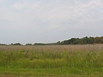
Kentmorr Airpark

1945 establishments in MarylandAirports established in 1945Airports in MarylandTransportation buildings and structures in Queen Anne's County, Maryland

(ICAO: K3W3, FAA LID: 3W3) is an airport located five miles south of Stevensville, Maryland, United States, on the Chesapeake Bay.

Excerpt from the Wikipedia article Kentmorr Airpark (License: CC BY-SA 3.0, Authors).

Kentmorr Airpark
Kent Island South Trail,

Geographical coordinates (GPS) Address External links Nearby Places
placeShow on map

Wikipedia: Kentmorr AirparkContinue reading on Wikipedia

Geographical coordinates (GPS)

Latitude Longitude
N 38.91797 ° E -76.35877 °
placeShow on map

Address

Kentmorr Airpark

Kent Island South Trail
21666
Maryland, United States
mapOpen on Google Maps

linkWikiData (Q19876597)
linkOpenStreetMap (90008264)

Share experience

Nearby Places

Kent Island (Maryland)

Kent Island is the largest island in the Chesapeake Bay and a historic place in Maryland. To the east, a narrow channel known as the Kent Narrows barely separates the island from the Delmarva Peninsula, and on the other side, the island is separated from Sandy Point, an area near Annapolis, by roughly four miles (6.4 km) of water. At only four miles wide, the main waterway of the bay is at its narrowest at this point and is spanned here by the Chesapeake Bay Bridge. The Chester River runs to the north of the island and empties into the Chesapeake Bay at Kent Island's Love Point. To the south of the island lies Eastern Bay. The United States Census Bureau reports that the island has 31.62 square miles (81.90 km2) of land area.Kent Island is part of Queen Anne's County, Maryland, and Maryland's Eastern Shore region. The first English establishment on the island, Kent Fort, was founded in 1631, making Kent Island the oldest English settlement within the present day state of Maryland and the third oldest permanent English settlement in what became the United States—after Jamestown, Virginia (1607), and Plymouth, Massachusetts (1620). The census-designated places of Stevensville and Chester are located on the island, along with several other communities, including the fishing community of Kent Narrows, which is located partially on the island. Although all of Kent Island's communities are unincorporated, the census designated places of Stevensville and Chester on the island are both more populous than any of Queen Anne's County's incorporated towns.

Chesapeake Bay Bridge

The Chesapeake Bay Bridge (also known locally as the Bay Bridge) is a major dual-span bridge in the U.S. state of Maryland. Spanning the Chesapeake Bay, it connects the state's rural Eastern Shore region with the urban Western Shore, between Stevensville and the capital city of Annapolis. The original span, opened in 1952 and with a length of 4.3 miles (6.9 km), was the world's longest continuous over-water steel structure. The parallel span was added in 1973. The bridge is officially named the Gov. William Preston Lane Jr. Memorial Bridge after William Preston Lane Jr. who, as the 52nd Governor of Maryland, initiated its construction in the late 1940s finally after decades of political indecision and public controversy. The bridge is part of U.S. Route 50 (US 50) and US 301, and serves as a vital link in both routes. As part of cross-country US 50, it connects the Baltimore–Washington Metropolitan Area with Ocean City, Maryland, Rehoboth Beach, Delaware, and other coastal tourist resort destinations. As part of US 301, it serves as part of an alternative route for Interstate 95 travelers, between northern Delaware and the Washington, D.C., area. Because of this linkage, the bridge is busy and has become known as a point of traffic congestion, particularly during peak hours and summer months. The bridge's role in transportation was filled by ferries prior to the first span's construction. An annual 10K run across the bridge has been organized on-and-off since 1975. The bridge's economic impact on the areas it connects has been significant, with both Queen Anne's County and Ocean City expanding significantly since the bridge's construction. Future expansion of the bridge has been discussed since 2004, with a task force being formed to investigate the possibility of building a third span. Because of similar names, it is often confused with the Chesapeake Bay Bridge–Tunnel, a bridge–tunnel linking the Eastern Shore of Virginia with the Hampton Roads region and the rest of Virginia.