Mole Valley

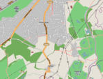
Mole Valley is a local government district in Surrey, England. Its council is based in Dorking. The other town in the district is Leatherhead. The largest villages are Ashtead, Fetcham and Great Bookham, in the northern third of the district. Most of the district is on the escarpments of or adjoins the Surrey Hills AONB (the North Downs and Greensand Ridge including locally Leith Hill, Polesden Lacey, Box Hill and Denbies Wine Estate, the largest vineyard in the country and several golf courses) The North Downs are followed or parallelled by the Pilgrims' Way. There are stations on the London–Worthing and Reading–Gatwick Airport railways, and in the northern third, a commuter stopping-service pattern line, London–Guildford (via Epsom) line. The A24 road and the M25 motorway are the main thoroughfares and relative to London the incidence of car ownership is high. The area hosts hill-focussed sub-laps of the London–Surrey Classic cycling tour each year.
Excerpt from the Wikipedia article Mole Valley (License: CC BY-SA 3.0, Authors, Images).Mole Valley
Warren Lane,
Geographical coordinates (GPS) Address Phone number Website Nearby Places Show on map
Geographical coordinates (GPS)
| Latitude | Longitude |
|---|---|
| N 51.316022222222 ° | E -0.49369722222222 ° |
Address
Pyrford Golf Club
Warren Lane
GU22 8XR
England, United Kingdom
Open on Google Maps


