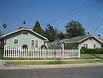
Fair Oaks Avenue (Pasadena, California)
Altadena, CaliforniaSouth Pasadena, CaliforniaStreets in Pasadena, California

Fair Oaks Avenue in Pasadena, California, is a major north–south road connecting the communities of Altadena, Pasadena, and South Pasadena, running 7.9 miles (12.7 km) in length. It starts at its southernmost end in South Pasadena at Huntington Drive. It travels due north to a terminus above Loma Alta Avenue in Altadena and the gates of Angelus County Park. Beyond this, the road becomes a private easement. At its meeting of Colorado Boulevard in Pasadena the two roads become the zero-zero, east–west, north–south postal division of Pasadena which carries on into Altadena. In South Pasadena, the street numbering varies with its own postal zip code.
Excerpt from the Wikipedia article Fair Oaks Avenue (Pasadena, California) (License: CC BY-SA 3.0, Authors, Images).Fair Oaks Avenue (Pasadena, California)
North Fair Oaks Avenue, Pasadena
Geographical coordinates (GPS) Address Nearby Places Show on map
Geographical coordinates (GPS)
| Latitude | Longitude |
|---|---|
| N 34.1541312 ° | E -118.150536 ° |
Address
Metro;Pasadena ARTS 51, 51s
North Fair Oaks Avenue
91001 Pasadena
California, United States
Open on Google Maps


