Scarpe (river)
Pages with French IPARamsar sites in Metropolitan FranceRivers of FranceRivers of Hauts-de-FranceRivers of Nord (French department) ... and 3 more
Rivers of the Pas-de-CalaisTributaries of the ScheldtWorld War I in the Pas-de-Calais

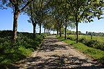
The Scarpe (French pronunciation: [skaʁp]) is a river in the Hauts-de-France region of France. It is a left-bank tributary of the river Escaut (Scheldt). It is 94 km (58 mi) long. The source of the river is at Berles-Monchel near Aubigny-en-Artois. It flows through the towns of Arras, Douai and Saint-Amand-les-Eaux. The river ends at Mortagne-du-Nord where it flows into the Scheldt. Scarpe Mountain in Alberta, Canada, was named after the river. The navigable waterway and its coal barges also feature in the novels by 19th century author Émile Zola.
Excerpt from the Wikipedia article Scarpe (river) (License: CC BY-SA 3.0, Authors, Images).Scarpe (river)
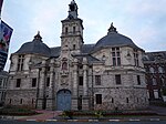
Quai de la Scarpe, Valenciennes
Geographical coordinates (GPS) Address Nearby Places Show on map
Geographical coordinates (GPS)
| Latitude | Longitude |
|---|---|
| N 50.499722222222 ° | E 3.4469444444444 ° |
Address
Quai de la Scarpe
59158 Valenciennes
Hauts-de-France, France
Open on Google Maps


