place

Novo Rio Bus Terminal

1965 establishments in BrazilBrazil transport stubsBrazilian building and structure stubsBuildings and structures completed in 1965Bus stations in Brazil
Public transport in Rio de Janeiro (city)
Rodoviária Novo Rio
Rodoviária Novo Rio

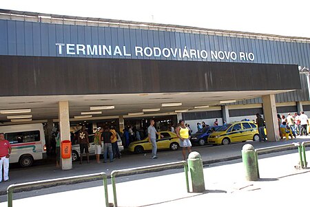
Novo Rio Bus Terminal (Portuguese: Terminal Rodoviário Novo Rio) is the main bus station in Rio de Janeiro, Rio de Janeiro State, Brazil. The terminal was constructed in 1965 and was built for the proximity to Centro and key routes in and out of Rio de Janeiro.

Excerpt from the Wikipedia article Novo Rio Bus Terminal (License: CC BY-SA 3.0, Authors, Images).

Novo Rio Bus Terminal
Avenida Francisco Bicalho, Rio de Janeiro Santo Cristo

Geographical coordinates (GPS) Address External links Nearby Places
placeShow on map

Wikipedia: Novo Rio Bus TerminalContinue reading on Wikipedia

Geographical coordinates (GPS)

Latitude Longitude
N -22.8993 ° E -43.2089 °
placeShow on map

Address

Rodoviária Novo Rio (Rodoviária do Rio de Janeiro)

Avenida Francisco Bicalho 1
20220-250 Rio de Janeiro, Santo Cristo
Rio de Janeiro, Brazil
mapOpen on Google Maps

linkWikiData (Q10380668)
linkOpenStreetMap (431600448)

Rodoviária Novo Rio
Rodoviária Novo Rio
Share experience

Nearby Places

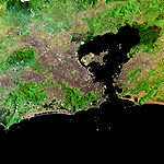
Greater Rio de Janeiro

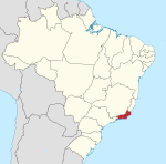
Greater Rio de Janeiro, officially the Rio de Janeiro Metropolitan Region (Grande Rio, officially Região Metropolitana do Rio de Janeiro, in Portuguese) is a large metropolitan area located in Rio de Janeiro state in Brazil, the second largest in Brazil and third largest in South America. It consists of 22 municipalities, including the state capital, Rio de Janeiro. The metropolitan area of Rio de Janeiro is known as a historical, cultural and economic centre of Brazil, with a total population of 13 million inhabitants. The region was first officially defined on July 1, 1974, less than 1 year before the fusion of Guanabara into Rio de Janeiro. Several municipalities show a high level of conurbation, with Rio de Janeiro–Baixada Fluminense and Niterói–São Gonçalo being the most clear examples. It was changed several times to include or remove different cities in different moments of the history, in the years 1993, 2001, 2002, 2009, 2013 and 2018. The water supply plans of the region are coordinated, and transportation in the area is heavily interconnected with urban intermunicipal buses to all municipalities in the area, trains over the capital to some Baixada Fluminense municipalities, ferry boats to some of the Guanabara Bay municipalities and major inter-city freeways such as the Rio–Niterói Bridge, Red Line, President Dutra freeway and the Niterói-Manilha freeway (pt). Most transportation methods are integrated with the capital inner-transportation system of buses, trains, metro, freeways and expressways.

Rio de Janeiro (state)

Rio de Janeiro (Portuguese pronunciation: [ˈʁi.u dʒi ʒɐˈne(j)ɾu] (listen), [ˈʁi.u dʒɐˈ-]) is one of the 27 federative units of Brazil. It has the second largest economy of Brazil, with the largest being that of the state of São Paulo. The state, which has 8.2% of the Brazilian population, is responsible for 9.2% of the Brazilian GDP.The state of Rio de Janeiro is located within the Brazilian geopolitical region classified as the Southeast (assigned by IBGE). Rio de Janeiro shares borders with all the other states in the same Southeast macroregion: Minas Gerais (N and NW), Espírito Santo (NE) and São Paulo (SW). It is bounded on the east and south by the South Atlantic Ocean. Rio de Janeiro has an area of 43,653 km2 (16,855 sq mi). Its capital is the city of Rio de Janeiro, which was the capital of the Portuguese Colony of Brazil from 1763 to 1815, of the following United Kingdom of Portugal, Brazil and the Algarves from 1815 to 1822, and of later independent Brazil as a kingdom and republic from 1822 to 1960. The state's 22 largest cities are Rio de Janeiro, São Gonçalo, Duque de Caxias, Nova Iguaçu, Niterói, Campos dos Goytacazes, Belford Roxo, São João de Meriti, Petrópolis, Volta Redonda, Magé, Macaé, Itaboraí, Cabo Frio, Armação dos Búzios, Angra dos Reis, Nova Friburgo, Barra Mansa, Barra do Piraí, Teresópolis, Mesquita and Nilópolis. Rio de Janeiro is the smallest state by area in the Southeast macroregion and one of the smallest in Brazil. It is, however, the third most populous Brazilian state, with a population of 16 million people in 2011 (making it the most densely populated state in Brazil) and has the third longest coastline in the country (after those of the states of Bahia and Maranhão). In the Brazilian flag, the state is represented by Mimosa, the beta star in the Southern Cross (β Cru).

Colégio Pedro II
Colégio Pedro II

Colégio Pedro II is a traditional federal public school, located in the state of Rio de Janeiro, Brazil. It is the third oldest active college in the country, after Ginásio Pernambucano and Atheneu Norte-Riograndense. The school was created in honor of its past patron, the emperor of Brazil, Dom Pedro II. Founded during the regency of the Marquis of Olinda, Pedro de Araújo Lima, it was part of a larger civilization project of the Brazilian Empire, which included the foundation of the Brazilian Historical and Geographical Institute and the Public Archive of the Empire, its contemporaries. Others, however, point to limitations of this view, suggesting other motivations for the creation of the college, mainly by pointing out that the transformation of the Seminary of São Joaquim into the College of Pedro II was based on the idea of the Reform of the Constitution in 1834, of building a model to be followed, since the provinces were not able to establish their local education system by themselves. Another group of authors, such as Circe Bittencourt, have established views that dialogue both perspectives. The format of the Colégio explains a lot of the Imperial civilizing plan: an education that prioritized a good education, but that covered a small part of society, which was sufficient to the Empire's project, insofar as it filled the basic cadres of the bureaucratic and ideological system to the country's leaders, with a curriculum that served these interests, not being so concerned with the formation of a broad mass of minimally trained workers, as would occur at later times in Brazil and already occurred in some places in Europe. It has 12 campuses in Rio de Janeiro, in the neighborhoods of Centro, São Cristóvão (3 units), Humaitá (2 units), Tijuca (2 units), Engenho Novo (2 units) and Realengo (2 units). It also has a campus in Niterói and another in Duque de Caxias.