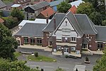
Capture of Gueudecourt

The Capture of Gueudecourt (26 September 1916) is a tactical incident of the First World War during the Battle of the Somme. The village lies on the Le Sars–Le Transloy road, north-east of Flers and north-west of Lesbœufs. Behind Gueudecourt lay open country which had hardly been shelled with Le Barque in the middle distance and then Bapaume beyond. German troops had passed through the village in late September 1914 during the First Battle of Albert, part of reciprocal attempts by the German and Franco-British armies to advance round the northern flank of their opponent during the operations known as the Race to the Sea. The village became a backwater until 1916 when the Germans built a third defensive position behind the Somme front, in preparation for the British–French offensive being prepared on the Somme. During the Battle of Flers–Courcelette (15–22 September) the Germans were forced back from Flers and the survivors retired to (Gallwitz Riegel), a defence line which ran in front of Gueudecourt. At the Battle of Morval (25–28 September), the first attack by the 21st Division on 25 September was stopped short of the village. Next day a combined operation by infantry, aircraft and a tank inflicted many casualties on the defenders and forced the survivors to surrender, after which the village was occupied and consolidated. To exploit the success, British cavalry went forward to probe the area around the village but were repulsed by machine-gun and artillery-fire from improvised German defences on Transloy Ridge. At the Battle of Le Transloy (1–28 October) and in local operations in November, Gueudecourt was used as a jumping-off point. In the winter of 1916–1917 the area was held by the I Anzac Corps, which considered the conditions around the village to be the worst on the Somme front. Gueudecourt became a backwater until 1918, when the village was lost on 24 March during Operation Michael, the German spring offensive and was recaptured for the last time on 28 August, by the 17th (Northern) Division, during the Second Battle of Bapaume.
Excerpt from the Wikipedia article Capture of Gueudecourt (License: CC BY-SA 3.0, Authors, Images).Capture of Gueudecourt
Rue de Caribou, Péronne
Geographical coordinates (GPS) Address Nearby Places Show on map
Geographical coordinates (GPS)
| Latitude | Longitude |
|---|---|
| N 50.059444444444 ° | E 2.8433333333333 ° |
Address
Rue de Caribou
Rue de Caribou
80360 Péronne
Hauts-de-France, France
Open on Google Maps


