Harborough District

Harborough () is a local government district in Leicestershire, England. It is named after its main town, Market Harborough, which is where the council is based. The district also includes the town of Lutterworth and numerous villages and surrounding rural areas. In the north of the district it includes parts of the Leicester Urban Area, notably at Thurnby, Bushby and Scraptoft. Covering 230 square miles (600 km2), the district is the largest by area of the eight districts in Leicestershire and covers almost a quarter of the county. The neighbouring districts are Blaby, Oadby and Wigston, Leicester, Charnwood, Melton, Rutland, North Northamptonshire, West Northamptonshire and Rugby.
Excerpt from the Wikipedia article Harborough District (License: CC BY-SA 3.0, Authors, Images).Harborough District
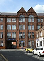
Adam and Eve Street, Harborough
Geographical coordinates (GPS) Address Nearby Places Show on map
Geographical coordinates (GPS)
| Latitude | Longitude |
|---|---|
| N 52.4785 ° | E -0.9206 ° |
Address
Sweet Peas Tea Room
Adam and Eve Street 23
LE16 7LT Harborough
England, United Kingdom
Open on Google Maps


