place

History of Westchester County

History of New York (state) by countyWestchester County, New York
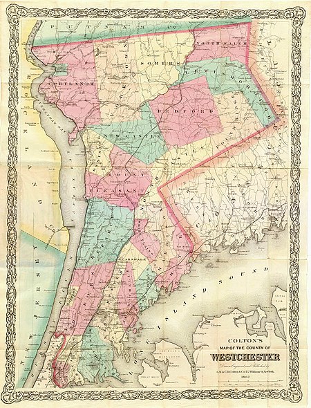
Colton westchester map

The history of Westchester County, a county in the state of New York, can be traced back to the founding of a settlement between the Hudson River and Long Island Sound in the 17th century. The area now known as Westchester County had seen human occupation since at least the Archaic period, but significant growth in the settlements that are now incorporated into the county did not occur until the Industrial Revolution.

Excerpt from the Wikipedia article History of Westchester County (License: CC BY-SA 3.0, Authors, Images).

History of Westchester County
Holbrook Road,

Geographical coordinates (GPS) Address Nearby Places
placeShow on map

Wikipedia: History of Westchester CountyContinue reading on Wikipedia

Geographical coordinates (GPS)

Latitude Longitude
N 41.15 ° E -73.85 °
placeShow on map

Address

Holbrook Road 54
10510
New York, United States
mapOpen on Google Maps

Colton westchester map
Share experience

Nearby Places

Briarcliff Farms
Briarcliff Farms

Briarcliff Farms was a farm established in 1890 by Walter William Law in Briarcliff Manor, a village in Westchester County, New York. One of several enterprises established by Law at the turn of the 20th century, the farm was known for its milk, butter, and cream and also produced other dairy products, American Beauty roses, bottled water, and print media. At its height, the farm was one of the largest dairy operations in the Northeastern United States, operating about 8,000 acres (10 sq mi) with over 1,000 Jersey cattle. In 1907, the farm moved to Pine Plains in New York's Dutchess County, and it was purchased by New York banker Oakleigh Thorne in 1918, who developed it into an Aberdeen Angus cattle farm. After Thorne's death in 1948, the farm changed hands several times; in 1968 it became Stockbriar Farm, a beef feeding operation. Stockbriar sold the farmland to its current owners in 1979. The farm combined a practical American business model with the concept of a European country seat or manor, with cows being milked constantly, and with milk promptly chilled and bottled within five minutes, and shipped to stores in New York City each night. The farm was progressive, with sterile conditions, numerous employee benefits, good living conditions for livestock, and regular veterinary inspections to maintain a healthy herd. The farm also made use of tenant farming, established working blacksmith, wheelwright, and harness shops on-site, was located around Walter Law's manor house, and constructed numerous buildings in the Tudor Revival architectural style. Briarcliff Farms was the original location for the School of Practical Agriculture and Horticulture, established by the New York State Committee for the Promotion of Agriculture in conjunction with Walter Law. The school's purpose was to teach students in farming, gardening, poultry-keeping, and other agriculture-related skills. The school moved to a farm near Poughkeepsie in 1903, and the school building was run as a hotel for two years until it became Miss Knox's School. After the building burned down in 1912, Miss Knox's School was relocated several times; since 1954, the Knox School has been located in St. James, New York.
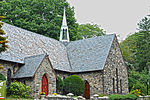
Briarcliff Manor, New York

Briarcliff Manor () is a suburban village in Westchester County, New York, 30 miles (50 km) north of New York City. It is on 5.9 square miles (15 km2) of land on the east bank of the Hudson River, geographically shared by the towns of Mount Pleasant and Ossining. Briarcliff Manor includes the communities of Scarborough and Chilmark, and is served by the Scarborough station of the Metro-North Railroad's Hudson Line. A section of the village, including buildings and homes covering 376 acres (152 ha), is part of the Scarborough Historic District and was listed on the National Register of Historic Places in 1984. The village motto is "A village between two rivers", reflecting Briarcliff Manor's location between the Hudson and Pocantico Rivers. Although the Pocantico is the primary boundary between Mount Pleasant and Ossining, since its incorporation the village has spread into Mount Pleasant. In the precolonial era, the village's area was inhabited by a band of the Wappinger tribes of Native Americans. In the early 19th century, the area was known as Whitson's Corners. Walter William Law moved to the area and purchased lands during the 1890s. Law developed the village, establishing schools, churches, parks, and the Briarcliff Lodge. Briarcliff Manor was incorporated as a village in 1902, and celebrated its centennial on November 21, 2002. The village has grown from 331 people when established to 7,867 in the 2010 census. Briarcliff Manor was historically known for its wealthy estate-owning families, including the Vanderbilts, Astors, and Rockefellers. It still remains primarily residential and its population is still considered affluent by U.S. standards. It has about 180 acres (70 ha) of recreational facilities and parks, all accessible to the public. The village has seven Christian churches for various denominations and two synagogues. The oldest church is Saint Mary's Episcopal Church, built in 1851. Briarcliff Manor has an elected local government, with departments including police, fire, recreation, and public works. It has a low crime rate: a 2012 study found it had the second-lowest in the state. In the New York State Legislature it is split between the New York State Assembly's 95th and 92nd districts, and the New York Senate's 38th and 40th districts. In Congress the village is in New York's 17th District.