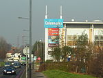
Russell Hill, Croydon
Areas of LondonDistricts of the London Borough of CroydonGothic Revival architecture in LondonGrade II listed buildings in the London Borough of CroydonLondon geography stubs ... and 5 more
London water infrastructureReservoirs in LondonSchools in the London Borough of CroydonThames WaterUse British English from September 2015
Russell Hill is an area in the London Borough of Croydon, located to the north-west of Purley. It is named after the former prime minister John Russell, 1st Earl Russell, who was President of the Warehousemen, Clerks and Drapers School which was built here in 1866. Prior to this the locality was known as Beggar's Thorn or Beggar's Bush, since at least the 10th century and survived until the early 20th century. The area is now home to Margaret Roper Catholic Primary School and Thomas More Catholic School.
Excerpt from the Wikipedia article Russell Hill, Croydon (License: CC BY-SA 3.0, Authors).Russell Hill, Croydon
London Roundshaw (London Borough of Sutton)
Geographical coordinates (GPS) Address Nearby Places Show on map
Geographical coordinates (GPS)
| Latitude | Longitude |
|---|---|
| N 51.353318 ° | E -0.126708 ° |
Address
London, Roundshaw (London Borough of Sutton)
England, United Kingdom
Open on Google Maps


