Fore Street, London
Streets in the City of LondonUse British English from April 2017

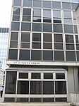
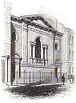
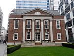
Fore Street is a street in the City of London near the Barbican Centre. It runs from Wood Street to Fore Street Avenue and is joined by Moor Lane on its north side. The street was extensively damaged by Nazi bombing during World War II and, following later development, nothing now remains of its original buildings other than St Giles-without-Cripplegate, which is a short distance away from the modern street.
Excerpt from the Wikipedia article Fore Street, London (License: CC BY-SA 3.0, Authors, Images).Fore Street, London
Fore Street, City of London
Geographical coordinates (GPS) Address Nearby Places Show on map
Geographical coordinates (GPS)
| Latitude | Longitude |
|---|---|
| N 51.5182 ° | E -0.0918 ° |
Address
Salters' Hall
Fore Street 4
EC2Y 5DB City of London
England, United Kingdom
Open on Google Maps


