Xoco
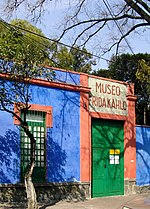
Xoco is a neighborhood of Mexico City in Benito Juárez borough. Xoco was originally a village dating to times before the Spanish conquest. Now it is an important commercial hot spot that lies just across the northern edge of Coyoacán, and is home to Centro Coyoacán and Patio Universidad shopping centers and the Torre Mitikah development, which will be Mexico City's biggest mixed used complex. Xoco is served by the Coyoacán station of the Mexico City metro which belongs to line 3. The national cinematheque, the Cineteca Nacional, also stands here and is home to a cemetery, the Panteón de Xoco, the IMER, the Instituto Nacional para el Desarrollo de los Pueblos Indígenas, and the Roberto Cantoral concert hall.
Excerpt from the Wikipedia article Xoco (License: CC BY-SA 3.0, Authors).Xoco
Avenida Universidad, Mexico City
Geographical coordinates (GPS) Address Nearby Places Show on map
 Continue reading on Wikipedia
 Geographical coordinates (GPS)
| Latitude | Longitude |
|---|---|
| N 19.366666666667 ° | E -99.166666666667 ° |
Address
Plaza Universidad
Avenida Universidad
03310 Mexico City
Mexico
Open on Google Maps