place

West Pennine Moors

Moorlands of EnglandTourist attractions in BlackburnTourist attractions in ChorleyTourist attractions in LancashireTourist attractions in the Metropolitan Borough of Bolton
West Pennine Moors
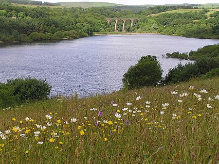
Wayoh Reservoir
Wayoh Reservoir

The West Pennine Moors is an area of the Pennines covering approximately 90 square miles (230 km2) of moorland and reservoirs in Lancashire and Greater Manchester, England. It is a Site of Special Scientific Interest.The West Pennine Moors are separated from the main Pennine range by the Irwell Valley to the east. The moorland includes Withnell, Anglezarke and Rivington Moors in the extreme west, Darwen and Turton Moors, Oswaldtwistle Moors and Holcombe Moors. These moors are lower in height than the main spine of the South Pennines. At 1,496 feet (456 m), the highest point is at Winter Hill. The area is of historical importance with archaeological evidence of human activity from Neolithic times. The area is close to urban areas, the dramatic backdrop to Bolton, Blackburn and Bury and neighbouring towns affording panoramic views across the Lancashire Plain and the Greater Manchester conurbation. The moorland is surrounded by the towns of Bolton, Chorley, Darwen, Horwich, Ramsbottom, Haslingden and Oswaldtwistle. Notable structures include Rivington Pike Tower, Winter Hill transmitting station, Peel Monument near Holcombe and the Jubilee Tower on Darwen Moor. United Utilities owns around 40% of the land for water catchment. The company operates four information centres at Rivington, Jumbles Country Park, Roddlesworth and Haslingden Grane.

Excerpt from the Wikipedia article West Pennine Moors (License: CC BY-SA 3.0, Authors, Images).

West Pennine Moors
Edge Lane,

Geographical coordinates (GPS) Address Nearby Places
placeShow on map

Wikipedia: West Pennine MoorsContinue reading on Wikipedia

Geographical coordinates (GPS)

Latitude Longitude
N 53.663 ° E -2.431 °
placeShow on map

Address

Edge Lane
BL7 0LU , North Turton
England, United Kingdom
mapOpen on Google Maps

Wayoh Reservoir
Wayoh Reservoir
Share experience

Nearby Places

Turton and Entwistle Reservoir

Turton and Entwistle Reservoir is a water reservoir in the village of Edgworth, Lancashire, England. The reservoir's existence is due to the Entwistle Dam. When constructed in 1832 the Entwistle Dam was the highest in Britain; it rises 108 feet from the base. The reservoir contains almost 750 thousand imperial gallons (roughly 3,400,000 litres) and, with the Wayoh Reservoir just below, satisfies around 50% of Bolton's need for drinking water.Entwistle Dam was designed by Thomas Ashworth, a local land surveyor, overseen by Jesse Hartley, the Liverpool Docks engineer. Other works were by Joseph Jackson, an engineer and surveyor from Bolton. It was built for the Commissioners of the Turton and Entwistle Reservoir, a group of local mill owners who obtained an enabling Act of Parliament in 1832 to regulate the supply of water in Bradshaw Brook for water power for the finishing textiles.Records suggest it was built entirely of puddle clay with no distinct core. Earth dams usually have a waterproof cutoff under their earthworks designed to stop seepage under the dam but it is doubtful whether there was any such a cutoff at Entwistle. The reservoir has a rock-cut outlet tunnel driven through the valley side rather than a culvert or pipeline and a siphon draw-off pipe. The dam is 108 ft high and 110 metres long at the crest. The present overflow channel and valve tower were added by the Bolton Corporation Water Works who took over the reservoir in 1864.