place

Thorpe Culvert railway station

DfT Category F1 stationsFormer Great Northern Railway stationsLow usage railway stations in the United KingdomRailway stations in Great Britain opened in 1871Railway stations in Lincolnshire
Railway stations served by East Midlands RailwayUse British English from October 2017
Thorpe Culvert railway station 1

Thorpe Culvert railway station serves the village of Thorpe St Peter in Lincolnshire, England. It is situated 7 miles (11 km) from Skegness and 16.75 miles (27 km) from Boston. The station is now owned by Network Rail and managed by East Midlands Railway who provide all rail services. A signal box is present at the West end of the station to supervise a level crossing, however, the station itself is unstaffed and offers limited facilities other than two shelters, bicycle storage, timetables and modern 'Help Points'. The full range of tickets for travel are purchased from the guard on the train at no extra cost, there are no retail facilities at this station.

Excerpt from the Wikipedia article Thorpe Culvert railway station (License: CC BY-SA 3.0, Authors, Images).

Thorpe Culvert railway station
Culvert Road, East Lindsey

Geographical coordinates (GPS) Address Nearby Places
placeShow on map

Wikipedia: Thorpe Culvert railway stationContinue reading on Wikipedia

Geographical coordinates (GPS)

Latitude Longitude
N 53.12303 ° E 0.19937 °
placeShow on map

Address

Culvert Road
PE24 4NL East Lindsey
England, United Kingdom
mapOpen on Google Maps

Thorpe Culvert railway station 1
Share experience

Nearby Places

Bratoft
Bratoft

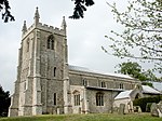
Bratoft is a small hamlet in the East Lindsey district of Lincolnshire, England. It is situated approximately 5 miles (8 km) east from Spilsby, 2 miles (3 km) west from Burgh Le Marsh, and south from the A158 road. Bratoft Grade II listed Anglican church is dedicated to St Peter and St Paul. The church was completely restored in 1890. The octagonal font dates from the early 15th century, and the chancel screen and parclose screens date from about 1460. On the north wall of the tower interior hangs a picture of the Armada, signed "Robert Stephenson". Between pictorial elements for England, Scotland, Ireland and France is depicted the Armada as a red dragon. The text beneath states: Spaine's proud Armado with great strength and powerGreat Britain's state came gapeing to devour,This Dragon's guts, like Pharaos scattered hoast,Lay splitt and drowned upon the Irish coast.For of eight score save two ships sent from SpaineBut twenty-five scarce sound return'd again. Non nobis Domine In 1747 the preacher and biblical commentator Thomas Scott was born in Bratoft. Near Bratoft is Gunby Hall, a National Trust property open to the public, a red-brick house, dating from 1700, with Victorian walled gardens, which Tennyson described as a "haunt of ancient peace", It is alleged that Sir William Massingberd's daughter tried to elope with one of his postilion riders but her father shot the man dead. Sir William was sentenced to appear in London annually at which time the family coat of arms was smeared with blood. It proved too much so Sir William demolished the family seat at Bratoft Castle and built Gunby Hall in 1700. It's said the ghosts of his daughter and the man walk on the path near the hall. Also within the village is Whitegates Cottage, a small thatched cottage dating from c.1770. Bratoft Meadow is an area of semi-natural species rich grassland. In 1970 a fertilizer experiment was set up to examine the effect of different forms and rates of fertilizer application on the conservation value of this type of old meadow. The particular species of interest in this study was the Green-winged Orchid Orchis morio.

Friskney Eaudyke
Friskney Eaudyke

Friskney Eaudyke is a settlement in the civil parish of Friskney, and the East Lindsey district of Lincolnshire, England. It is 11 miles (20 km) north-east from Boston and 30 miles (50 km) east-southeast from the city and county town of Lincoln. Friskney Eaudyke is 1 mile (1.6 km) east from the parish village of Friskney, and the same distance north-east from the parish hamlet of Fold Hill. The A52 road, which runs locally from Boston to Skegness, is 800 yards (700 m) south-east.The settlement is centred on the northwest-to-southeast Eau Dyke Road, between Low Road at the north-west and the staggered junction with Sickling Lane and Chapel Lane at the south-east. Friskney Eaudyke comprises detached and semidetached houses, farms with associated buildings, a farm produce distribution company, a balloon supply & event company, a garage services company, and Grade II listed buildings.The listed Bridge Farmhouse, a late 18th-century two-storey red brick house, is on Low Road south from the junction with Eau Dyke Road. Over the junction and further north on Low Road is Ash Tree Farmhouse, a mid-18th to mid-19th-century gabled red brick house. At the north on Mill Lane off Low Road, and near the border with Wainfleet St Mary, is Hoyle's Windmill, of three-storeys and today converted to a storehouse by the addition of an attached building. Largely early 19th-century, it dates from 1730. At the south-west on Chapel Lane is the Grade II* listed 19th-century red brick Wesleyan Centenary Chapel, dating to 1839.In 1871 "Ancient British" pottery, and fragments of bone were found by workmen on Eaudyke Road at the south-east of the settlement. Kelly's Directory in 1885 noted the 1871 archeological finds by workmen as they were building the infants' school at 'Eaudyke'. The directory records a schoolmistress, and the Wesleyan chapel which it said was built in 1832. The listed trades at 'Eaudyke' in the 1933 Kelly's Directory included five farmers, a potato merchant, a saddler, a beer retailer, a shopkeeper, a grocer, a butcher, a baker, and a motor engineer.

Great Steeping
Great Steeping

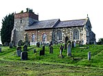
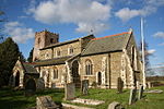
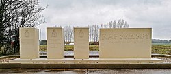
Great Steeping is a village and civil parish in the East Lindsey district of Lincolnshire, England. It is situated approximately 3 miles (5 km) from Spilsby. The parish includes the hamlet of Monksthorpe. There are two churches dedicated to All Saints, one being redundant and now known as Old All Saints. Old All Saints, built in 1748 on the site of a medieval church, and restored in 1908, is a Grade II* listed building. The Diocese of Lincoln declared it redundant in August 1973. In the grounds is the socket stone of a medieval churchyard cross which is an ancient scheduled monument.All Saints Church was built of red brick in 1891, after a design by William Bassett-Smith. It is Grade II listed, and has a listed churchyard cross.Great Steeping Primary School was built in 1859, and later run by the Great Steeping School Board from 1876 to 1903 as Great Steeping Board School.Kelsey Hall dates from 1854 but occupies the site of an earlier manor house which burnt down. It is first noted in 1507 as "Kelsayhall" and its name derives from the Kelsey family associated with Great Steeping. Old documents refer to "William de Kellessay in Steping" in 1299, and Ralph de Kelsay in 1327. Kelsey Hall is a private house.Great Steeping was also the base for RAF Spilsby, which originally was to be on the site of Gunby Park. However, after an appeal by Field Marshal Sir Archibald Montgomery-Massingberd of Gunby Hall to the King, the RAF Steeping airfield was built as RAF Spilsby. It opened in September 1943, and in 1944 RAF Spilsby, RAF Strubby, and RAF East Kirkby joined to become the newly formed 55 Base with headquarters at East Kirkby. In September 1944 RAF Spilsby became a station for two Lancaster squadrons, the 207 and 44. It was taken over by No 2 Armament Practice School from 1945 until November 1946, after which the station was placed on care and maintenance until 1955. It re-opened to host ground units of the USAF until they moved out in 1958.