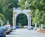
Stepney, Kingston upon Hull
Geographic histories of Kingston upon HullUse British English from June 2019Wards and districts of Kingston upon Hull

Stepney is an area of Kingston upon Hull within the larger area of Sculcoates, north of the city centre on the (A1079) Beverley-Hull main road. Before the mid-19th century the place was a small hamlet outside the urban area of Kingston upon Hull.
Excerpt from the Wikipedia article Stepney, Kingston upon Hull (License: CC BY-SA 3.0, Authors, Images).Stepney, Kingston upon Hull
Beverley Road, Hull Sculcoates
Geographical coordinates (GPS) Address Phone number Website Nearby Places Show on map
Geographical coordinates (GPS)
| Latitude | Longitude |
|---|---|
| N 53.758611111111 ° | E -0.34916666666667 ° |
Address
Stepney Primary School
Beverley Road
HU5 1JJ Hull, Sculcoates
England, United Kingdom
Open on Google Maps


