place

17 State Street

Emery Roth buildingsEmporis template using building IDFinancial District, ManhattanOffice buildings completed in 1988Privately owned public spaces
Skyscraper office buildings in ManhattanUse American English from August 2019Use mdy dates from August 2019
17 State Street, Downtown panoramio crop

17 State Street is a 42-story office building located in the Financial District of Manhattan, overlooking State Street and Battery Park. It was designed by Roy Gee for Emery Roth and Sons for developers William Kaufman Organization, and it is most noted for its distinct curved glass facade. The building has been owned by RFR Holding since 1999 when it was acquired from Savannah Teachers Properties Inc. for $120 million.17 State Street was affected by Hurricane Sandy in October 2012, primarily by water damage to electrical equipment in the building's basement. For that reason, the building was closed for repairs for approximately two weeks and was one of the earliest office buildings in the Financial District to be reoccupied after the storm.

Excerpt from the Wikipedia article 17 State Street (License: CC BY-SA 3.0, Authors, Images).

17 State Street
State Street, New York Manhattan

Geographical coordinates (GPS) Address External links Nearby Places
placeShow on map

Wikipedia: 17 State StreetContinue reading on Wikipedia

Geographical coordinates (GPS)

Latitude Longitude
N 40.702795 ° E -74.01412 °
placeShow on map

Address

17 State Street

State Street
10275 New York, Manhattan
New York, United States
mapOpen on Google Maps

linkWikiData (Q3499774)
linkOpenStreetMap (274483198)

17 State Street, Downtown panoramio crop
Share experience

Nearby Places

South Ferry station (IRT elevated)

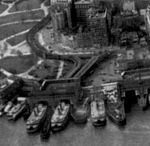
South Ferry was an elevated station at the southern terminal of the IRT Second, Third, Sixth and Ninth Avenue Lines. It was located next to Battery Park at the lower tip of Manhattan, New York City. Two tracks came from the combined Second and Third Avenue Lines, and two from the Sixth and Ninth Avenue Lines, making four tracks at the terminal, with platforms on the outside and between each pair of tracks (no platform in the center). The station was right above access to various ferries at South Ferry, at both the Battery Maritime Building and the Whitehall Terminal. The next stop on the Second and Third Avenue Lines was Hanover Square. The next stop on the Sixth and Ninth Avenue Lines was Battery Place. The first elevated station at South Ferry was opened April 5, 1877 by the New York Elevated Railroad. It had one island platform between two tracks and was operated as an extension of the company's Ninth Avenue Line. The tracks were later continued straight into the company's Third Avenue Line, which opened August 26, 1878. The four-track station, opened March 1879, was built to provide an adequate terminal for both lines. It was located on a very short branch line, at right angles to the old station, facing toward the ferry terminals. Later the Second and Sixth Avenue Lines also used the terminal. A fire at the station in 1919 damaged the Whitehall Street Terminal.: 55 Ridership on the els began to decline as subway stations were replacing them. The Sixth Avenue Line was eliminated from the station in 1938, the Ninth Avenue Line in 1940, and the Second Avenue Line in 1942. When the Third Avenue Line was eliminated in 1950, the station was permanently closed. The station site is currently occupied by the South Ferry subway station.

South Ferry/Whitehall Street station

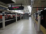
The South Ferry/Whitehall Street station is a New York City Subway station complex in the Manhattan neighborhood of Financial District, under Battery Park. The complex is shared by the IRT Broadway–Seventh Avenue Line and the BMT Broadway Line. It is served by the 1 and R trains at all times, the N train during late nights only, and the W train during weekdays only. The complex originally consisted of three separate stations. In 1905, the Interborough Rapid Transit Company (IRT) opened a balloon loop at South Ferry, serving the IRT Broadway–Seventh Avenue and IRT Lexington Avenue Lines. The Brooklyn–Manhattan Transit Corporation (BMT) opened its station at Whitehall Street in 1918. The same year, the IRT opened a second loop for the IRT Lexington Avenue Line on the inside of the existing loop; the two loop stations were not connected to each other nor to the BMT station. Despite their proximity, the stations remained separate for 91 years. In the early 2000s, as part of the recovery effort from the September 11, 2001, attacks, a new South Ferry terminal for the Broadway–Seventh Avenue Line was proposed. That station opened in 2009, replacing the loop station and providing a connection between the Broadway–Seventh Avenue Line's 1 train and the Broadway Line's N, R, and W trains. The new terminal for the Broadway–Seventh Avenue Line was severely damaged during Hurricane Sandy in 2012, and the MTA temporarily re-opened the loop station between 2013 and 2017, adding a temporary connection between the IRT Broadway–Seventh Avenue Line's loop and the BMT Broadway Line's platforms. The newer terminal reopened in June 2017 following extensive renovations and waterproofing work. This station complex is the third on the site to bear the name South Ferry. The first was an elevated station located nearby, which was open from 1877 to 1950 and served the former IRT Ninth, Sixth, Third, and Second Avenue elevated lines. The second was the old South Ferry loop station, located above the existing station complex.