place

Idaho Maximum Security Institution

1989 establishments in IdahoBuildings and structures in Ada County, IdahoCapital punishment in IdahoExecution sites in the United StatesIdaho stubs
Prisons in Idaho

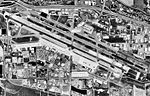
Idaho Maximum Security Institution (IMSI) is a maximum-security prison located near Kuna, Idaho, one of a cluster of seven detention facilities known as the "South Boise Prison Complex". The other prisons in the area are the Correctional Alternative Placement Program, the Idaho State Correctional Center, the Idaho State Correctional Institution, the South Boise Women's Correctional Center, the South Idaho Correctional Institution, and the South Idaho Correctional Institution-Community Work Center. IMSI houses Idaho's death row for men and execution chamber. The IMSI prison was opened in November 1989 to confine Idaho's most violent offenders. The compound is located within a double perimeter fence reinforced with razor wire, an electronic detection system and a 24-hour armed perimeter patrol. The offender population includes many mental health offenders, including subjects of civil commitments. Thirty beds are dedicated for prisoners with acute mental illness. IMSI has restrictive housing beds dedicated to administrative segregation, disciplinary detention and death row. The remaining beds are allocated for close-custody general population offenders.

Excerpt from the Wikipedia article Idaho Maximum Security Institution (License: CC BY-SA 3.0, Authors).

Idaho Maximum Security Institution
South Pleasant Valley Road,

Geographical coordinates (GPS) Address Phone number Website Nearby Places
placeShow on map

Wikipedia: Idaho Maximum Security InstitutionContinue reading on Wikipedia

Geographical coordinates (GPS)

Latitude Longitude
N 43.479026 ° E -116.218779 °
placeShow on map

Address

Idaho State Correctional Institution

South Pleasant Valley Road 13500
83634
Idaho, United States
mapOpen on Google Maps

Phone number

call+12083360740

Website
idoc.idaho.gov

linkVisit website

Share experience

Nearby Places

Idaho State Correctional Institution

Idaho State Correctional Institution (ISCI), also referred to as "The Yard," is an Idaho Department of Correction state prison for men in unincorporated Ada County, Idaho, near Kuna. Located in the desert five miles south of the Boise Airport, it is one of a six residential detention facilities known as the "South Boise Prison Complex." The other prisons in the area are the Correctional Alternative Placement Program (CAPP), the Idaho State Correctional Center (ISCC), the Idaho Maximum Security Institution (IMSI), the South Boise Women's Correctional Center (SBWCC), the South Idaho Correctional Institution (SICI) also referred to as "The Farm." The South Boise Complex also includes two Community Reentry Centers. ISCI is the oldest operating prison in the state, with a capacity of 1,446, with special-use beds for infirmary, outpatient mental health, and geriatric residents. Its reception and diagnostic unit (RDU) serves as the entry point for all men entering Idaho's prison system. ISCI was opened in December 1973 as the state prison, after serious riots in 1971 and 1973 destroyed much of the century-old Idaho State Penitentiary in east Boise. A riot in the summer of 1980 at the prison caused damages in the millions of dollars, mostly in the maximum security area.The institution is surrounded by a double fence, patrolled by sentry dogs, with six operational towers to monitor perimeter security and resident movement. The facility includes a religious activities center, a fully-equipped recreation facility with two large tracks and ballfields, an accredited school, a large industrial workspace for vocational rehabilitation and job training programs, and a fully functioning medical clinic with 28 inpatient beds. ISCI also hosts the Inmate Dog Alliance Program of Idaho (IDAPI). This program takes dogs from the Humane Society, and places them with an inmate. The goal of the program is to prepare the dogs for adoption, as well as providing therapeutic opportunities for the participating residents. On Easter Sunday in 1986, convicted felon Claude Dallas escaped from ISCI. Some believe he accomplished this by walking out with a group of visitors, although this remains in dispute. The escape spurred an almost year-long manhunt that ended in suburban southern California.

Idaho State Correctional Center

Idaho State Correctional Center (ISCC) is a state prison for men located in Kuna, Ada County, Idaho, one of a cluster of seven detention facilities known as the "South Boise Prison Complex". The other prisons in the area are the Correctional Alternative Placement Program, the Idaho State Correctional Institution, the Idaho Maximum Security Institution, the South Boise Women's Correctional Center, the South Idaho Correctional Institution, and the South Idaho Correctional Institution-Community Work Center. The ISCC opened in July 2000 as the first privately run prison in Idaho, operated by the Corrections Corporation of America. With a capacity of 2,080 inmates, it is also the largest prison in the state, housing maximum, medium, and minimum custody male offenders.In January 2014, Idaho governor Butch Otter announced that the state would take over control of the facility when the contract expired in June 2014, citing a long history of issues including violence within the facility and allegations of understaffing and contract fraud. Governor Otter himself has been a proponent of privatization.In 2014, the Federal Bureau of Investigation began an investigation of the CCA management of the prison. The American Civil Liberties Union, which sued on behalf of inmates in 2010, claimed that understaffing resulted in high levels of violence at the facility, which prompted some inmates to refer to it as a "gladiator school."The ISCC maintains an active branch of the American Legion.

Boise Airport
Boise Airport

Boise Airport (IATA: BOI, ICAO: KBOI, FAA LID: BOI) (Boise Air Terminal or Gowen Field) is a joint civil-military airport in the western United States, three miles (5 km) south of downtown Boise in Ada County, Idaho. The airport is operated by the city of Boise Department of Aviation and is overseen by an airport commission. It is the busiest airport in the state of Idaho, serving more passengers than all other Idaho airports combined and roughly ten times as many passengers as Idaho's second busiest airport, Idaho Falls Regional Airport.Boise is a landing rights airfield requiring international general aviation flights to receive permission from a Customs and Border Protection officer before landing. In addition to being a commercial and general aviation airport, Boise also functions concurrently as a USAF military facility as used by the 124th Fighter Wing (124 FW) of the Idaho Air National Guard on the Gowen Field Air National Guard Base portion of the airport. The 124 FW operates the A-10 Thunderbolt II aircraft. The National Interagency Fire Center (NIFC) is based in the city of Boise and the Boise Airport is used for logistical support. The United States Forest Service (USFS) also uses Boise Airport as a base for aerial firefighting air tankers during the wildfire season.Boise Airport enplaned 2,059,935 passengers in 2019, an increase of 6% vs. 2018 when 1,938,416 passengers were enplaned (making it the 69th busiest airport in the country).

Oregon Trail (Ada County, Idaho segment)

The Oregon Trail (Ada County, Idaho segment) near Boise, Idaho, includes approximately eight miles of the Oregon Trail as it entered the Boise Valley. The segment was added to the National Register of Historic Places (NRHP) in 1972. At the time of the NRHP nomination, wagon tracks from the Oregon Trail could be identified almost continuously from the northwest and northeast quadrants of Section 36, Range 2 East, Township 2 North through the northwest and northeast quadrants of both Section 31, Range 3 East, Township 2 North and Section 24, Range 3 East, Township 1 North. In places along the segment the wagon tracks were eight tracks wide. The length of the segment is roughly from 43.56055556°N 116.15527778°W / 43.56055556; -116.15527778 to 43.5143915°N 116.1526384°W / 43.5143915; -116.1526384.The Oregon Trail Reserve is a 77-acre site managed by Boise Parks and Recreation, and the area includes part of the Oregon Trail segment designated by the NRHP in 1972. Nearby is the Oregon Trail Recreation Area, another part of the NRHP segment managed by Boise Parks and Recreation.Although the Oregon Trail followed the segment identified in the NRHP listing, it then continued along the route of what is now Boise Avenue. The Capitol Boulevard Memorial Bridge, also known as the Oregon Trail Memorial Bridge, is located where the Oregon Trail crossed the Boise River by ferry and proceeded through Boise City west toward Caldwell. A series of 21 obelisks now mark the route of the Oregon Trail through Boise.