National Weather Service Boise, Idaho

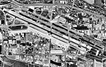
The National Weather Service Boise, Idaho is a weather forecast office responsible for weather forecasts, warnings and local statements as well as aviation weather forecasts and fire weather forecasts for 3 counties in Southeast Oregon and 14 counties in Southwest and South central Idaho. The U.S. Weather Bureau established an office in the Sonna Building on December 1, 1898. Since then, the U.S Weather Bureau office, now known as the National Weather Service forecast office gained forecast responsibility of Southern Idaho on June 22, 1970 which was expanded to the entire state of Idaho in 1973. After modernization in 1993, the forecast responsibility was changed to Southeast Oregon and Southwest Idaho. The current office in Boise maintains a WSR-88D (NEXRAD) radar system, 8 Automated airport weather station (ASOS) systems and Advanced Weather Interactive Processing System (AWIPS) that greatly improve forecasting in the region. Continuous weather observations have been maintained for the city of Boise since February 1, 1864 about 5 months after the U.S. Army established Fort Boise. The post surgeon for the U.S. Army took observations until July 1, 1877 when the U.S. Signal Service, established an office downtown. The Signal Office was discontinued on July 1, 1890.
Excerpt from the Wikipedia article National Weather Service Boise, Idaho (License: CC BY-SA 3.0, Authors, Images).National Weather Service Boise, Idaho
West Robinson Road, Boise
Geographical coordinates (GPS) Address Nearby Places Show on map
 Continue reading on Wikipedia
 Geographical coordinates (GPS)
| Latitude | Longitude |
|---|---|
| N 43.567297222222 ° | E -116.21149444444 ° |
Address
National Weather Service
West Robinson Road
83705 Boise
Idaho, United States
Open on Google Maps