place

Lipson Co-operative Academy

Academies in Plymouth, DevonDevon building and structure stubsSecondary schools in Plymouth, DevonSouth West England school stubsUse British English from February 2023

Lipson Co-operative Academy (formerly Lipson Community College) is a coeducational secondary school and sixth form with academy status, located in the Lipson area of Plymouth in the English county of Devon.Previously a foundation school administered by Plymouth City Council, Lipson Community College converted to academy status on 1 April 2011 using the Co-operative academy model of governance. It was renamed Lipson Co-operative Academy. However, the school continues to coordinate with Plymouth City Council for admissions. Lipson Co-operative Academy offers GCSEs and BTECs as programmes of study for pupils, while students in the sixth form have the option to study from a range of A-levels, OCR Nationals and further BTECs. Some courses are offered in conjunction with Sir John Hunt Community Sports College and Tor Bridge High. The school also houses the Plymouth associate branch of the Italia Conti Academy, and is the home ground for Plym Valley Ladies Hockey Club and Plymouth University Hockey Club.

Excerpt from the Wikipedia article Lipson Co-operative Academy (License: CC BY-SA 3.0, Authors).

Lipson Co-operative Academy
Bernice Terrace, Plymouth Lipson

Geographical coordinates (GPS) Address Phone number Website External links Nearby Places
placeShow on map

Wikipedia: Lipson Co-operative AcademyContinue reading on Wikipedia

Geographical coordinates (GPS)

Latitude Longitude
N 50.38153 ° E -4.11089 °
placeShow on map

Address

Lipson Co-operative Academy

Bernice Terrace
PL4 7PG Plymouth, Lipson
England, United Kingdom
mapOpen on Google Maps

Phone number
Lipson Co-operative Academy TRust

call+441752671318

Website
lipsonco-operativeacademy.coop

linkVisit website

linkWikiData (Q16996378)
linkOpenStreetMap (258660521)

Share experience

Nearby Places

Laira
Laira

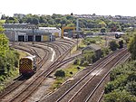
Laira – previously recorded as Lare (1591), Lary poynte (1638), the Leerie (1643), and the Lairy (1802) – was originally the name given to that part of the estuary of the River Plym from the Cattewater up to Marsh Mills in Plymouth, Devon, England. The name may derive from a Brythonic word corresponding to the Welsh llaeru, meaning 'to ebb'.The A379 road and the disused Plymouth to Yealmpton railway line cross the estuary just above the Plymouth suburb of Cattedown by two bridges both known as Laira Bridge. The name Laira now also refers to the area of Plymouth surrounding the Laira Traction Maintenance Depot. Much of the housing here was built around 1900 for employees of the depot. There is a memorial plaque to the men of Laira who died in the Great War along Old Laira Road. Also situated on Old Laira Road is the old Police / Fire Station which is currently used as a library. Laira Green Primary school is situated in the area, as well as a disused United Reformed Church. Until the beginning of the 19th century, Old Laira Road had constituted the northern shore of Lipson Lake (or Bay), an extensive tidal inlet on the western side of the estuary. This area – on which the railway depot and Lipson Co-operative Academy now stand – was reclaimed from the estuary and drained, together with Tothill Bay on the south side of higher ground at Mount Gould, upon the completion in 1802 of an embankment along the whole western shore of the Laira. A new road, laid along this embankment shortly afterwards, from Laira Green to Prince Rock, soon became the main highway into Plymouth from Plympton, Exeter, and beyond, avoiding the often steep and narrow way via Old Laira Road and Lipson – even though the new route was to remain a toll road until 1924.

Lipson
Lipson

Lipson is a ward in the city of Plymouth, England. It is an area with mixed terraced housing, some subdivided into bedsits and flats and a public open-space called 'Freedom Fields', a Civil War battle site where the townsfolk of nearby Plymouth resisted substantial Cavalier raiding parties and enabled the town to sustain the royalist siege. Freedom Fields existed before the Civil War and acquired its name after the defeat there of a French invasion force two hundred years earlier. The park was the inspiration behind the title of local folk singer-songwriter Seth Lakeman's third album and currently has a small cafe, numerous benches and flower-beds. Formerly the site of Plymouth's biggest hospital (Freedom Fields Hospital), the borough prison, and fire and ambulance stations, it now retains only the (rebuilt) fire station. Much of the housing stock consists of Victorian and Edwardian terraces with a few larger detached and semi-detached housing around the Queen's Gate/ Queen's Road area. Due in part to its proximity to the city's university and the size of some of the older properties, some of the housing towards Greenbank has been subdivided into homes of multiple occupancy and flats. Social housing can be found to the north-east along Lipstone Crescent. Because of its hilly position, much of the area offers panoramic views in most directions, not least south across Plymouth Sound. Plymouth's main retail shopping centre, Plymouth University, and Plymouth Railway Station are all within reasonable walking distance. Shopping in Lipson is limited to a handful of takeaways and small grocery shops. Currently, as of 2021, there is a small Tesco outlet near Lipson Vale. Lipson has a few schools, including Lipson Co-operative Academy. Public transport is provided by Plymouth Citybus in the form of three bus routes. 8/9 and 20/21 via Lipson Vale and 23/24 via the Queens Road Triangle and the Mount Gould estate and hospital.