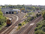
Laira Bridge
Bridges completed in 1887Railway bridges in DevonUse British English from December 2016

Laira Bridge is a disused railway bridge that crosses the River Plym in the city of Plymouth, Devon, England. In 2015, it was refurbished to carry a pedestrian and cycle path. The name is also used to refer to the road bridge that runs alongside and carries the A379 road.
Excerpt from the Wikipedia article Laira Bridge (License: CC BY-SA 3.0, Authors, Images).Laira Bridge
Old Laira Bridge, Plymouth Oreston
Geographical coordinates (GPS) Address External links Nearby Places Show on map
Geographical coordinates (GPS)
| Latitude | Longitude |
|---|---|
| N 50.36909 ° | E -4.10845 ° |
Address
Old Laira Bridge
Old Laira Bridge
PL9 7JD Plymouth, Oreston
England, United Kingdom
Open on Google Maps


