place

Fort Efford

Forts of Plymouth, DevonPalmerston Forts
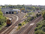
Efford Emplacement geograph.org.uk 1524083

Fort Efford is a former 19th-century Fort, built as a result of the Royal Commission on National Defence of 1859. It was built to defend the landward approaches to the North East of Plymouth. This was part of an overall scheme for the defence of the Royal Naval Dockyard at Devonport, Plymouth. They were known as Palmerston Forts after the Prime Minister who championed the scheme. Designed by Captain (later Maj General) Edmund Frederick Du Cane, it was built by George Baker and Company and finished by the Royal Engineers. It was armed with 21 guns, some of which flanked the nearby Laira Battery. To house part of the Forts' Garrison a barrack block to house five officers and 108 men was built within the rear section of the Fort. In the 1890s a moveable armament shed was built on the parade ground to house two 5-inch Breech Loading guns. By the early 1900s the Fort had become obsolete as a defensive position and was disarmed. During the Second World War it was used for ammunition storage. It was sold by the War Office in 1961. It was Grade II listed in 2003. It has been used for storage by the Showman's Guild for many years.

Excerpt from the Wikipedia article Fort Efford (License: CC BY-SA 3.0, Authors, Images).

Fort Efford
Efford Road, Plymouth Higher Compton

Geographical coordinates (GPS) Address Nearby Places
placeShow on map

Wikipedia: Fort EffordContinue reading on Wikipedia

Geographical coordinates (GPS)

Latitude Longitude
N 50.389167 ° E -4.11 °
placeShow on map

Address

Efford Road

Efford Road
PL3 6NF Plymouth, Higher Compton
England, United Kingdom
mapOpen on Google Maps

Efford Emplacement geograph.org.uk 1524083
Share experience

Nearby Places

Eggbuckland
Eggbuckland

Eggbuckland is a suburb of the city of Plymouth in the county of Devon, England. Before the Second World War Eggbuckland was a small village a few miles north of Plymouth. During the reconstruction of Plymouth many new suburbs were built and soon a new estate was built within one mile to the south east of Eggbuckland. During the 1970s the areas in between and surrounding the old village were all developed and the whole area is now referred to by the name Eggbuckland. The development of the A38 just south of Eggbuckland in the 1980s led to the area becoming very popular with commuters. Bocheland is of Saxon origin and means "Royal land held by charter". The Domesday Book of 1086 recorded that this manor was held by the King, William of Normandy, but was granted to the Saxon Heche or Ecca, thus the land was known as Heche or Ecca's Bocheland. This was the site of a Saxon church which was replaced by the present church of St Edward in 1470. The village was held by the Royalist Cavaliers during the Civil War against the Parliamentarian Roundheads and was badly damaged. During the 19th century the area was host to new Palmerston Forts built as part of a northern defense line around Plymouth. Much of the structures remain but are privately owned and used for differing purposes. Over time the name has been corrupted and by 1685 was Egg Buckland. By 1902, it was one word - Eggbuckland although the older usage is still seen around the city. In the 1870s, the original village was described thus in John Marius Wilson's Imperial Gazetteer of England and Wales: EGG-BUCKLAND, or Buckland-Egg, a parish in Plympton-St. Mary district, Devon; on the Dartmoor railway, adjacent to the Tavistock railway, and near the river Plym, 3 miles NNE of Plymonth. It contains Crabtree hamlet, and part of Knackers-Knowle village; and its post town is Knackers-Knowle, Devon. Acres, with Laira-Green, 3, 304; of which 100 are water. Real property, £8, 933; of which £68 are in quarries, and £36 in railways. Pop., 1, 348. Houses, 272. The property is much subdivided. Widey Court here was the headquarters of Prince Maurice during his siege of Plymouth, and was visited by the king. The living is a vicarage in the diocese of Exeter. Value, £474.* Patron, the Lord Chancellor. The church is ancient: consists of nave, south aisle, and chancel, with a tower; and is in fair condition. Charities, £28.The suburb is home to Eggbuckland Community College and several primary schools.

Laira
Laira

Laira – previously recorded as Lare (1591), Lary poynte (1638), the Leerie (1643), and the Lairy (1802) – was originally the name given to that part of the estuary of the River Plym from the Cattewater up to Marsh Mills in Plymouth, Devon, England. The name may derive from a Brythonic word corresponding to the Welsh llaeru, meaning 'to ebb'.The A379 road and the disused Plymouth to Yealmpton railway line cross the estuary just above the Plymouth suburb of Cattedown by two bridges both known as Laira Bridge. The name Laira now also refers to the area of Plymouth surrounding the Laira Traction Maintenance Depot. Much of the housing here was built around 1900 for employees of the depot. There is a memorial plaque to the men of Laira who died in the Great War along Old Laira Road. Also situated on Old Laira Road is the old Police / Fire Station which is currently used as a library. Laira Green Primary school is situated in the area, as well as a disused United Reformed Church. Until the beginning of the 19th century, Old Laira Road had constituted the northern shore of Lipson Lake (or Bay), an extensive tidal inlet on the western side of the estuary. This area – on which the railway depot and Lipson Co-operative Academy now stand – was reclaimed from the estuary and drained, together with Tothill Bay on the south side of higher ground at Mount Gould, upon the completion in 1802 of an embankment along the whole western shore of the Laira. A new road, laid along this embankment shortly afterwards, from Laira Green to Prince Rock, soon became the main highway into Plymouth from Plympton, Exeter, and beyond, avoiding the often steep and narrow way via Old Laira Road and Lipson – even though the new route was to remain a toll road until 1924.