place

Lyefjell

Rogaland geography stubsTime, NorwayVillages in Rogaland
Lyefjell
Lyefjell

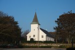
Lyefjell is a village in Time municipality in Rogaland county, Norway. The village is located in the hills about 5 kilometres (3.1 mi) east of the town of Bryne and about 5 kilometres (3.1 mi) north of the villages of Mossige and Undheim. The village is a residential area that was built in the hills so that the flat, agricultural areas could continue to be used for farming. It is just to the south of the mountain Njåfjellet and the village has views of the flat plains of Jæren below. The 0.87-square-kilometre (210-acre) village has a population (2015) of 2,253 which gives the village a population density of 2,590 inhabitants per square kilometre (6,700/sq mi). There is an elementary and middle school in Lyefjell as well as three large pre-schools. There is also a well stocked grocery store right next to the local auto shop. The grocery store also serves as a delivery point for packages for Posten and Postnord.

Excerpt from the Wikipedia article Lyefjell (License: CC BY-SA 3.0, Authors, Images).

Lyefjell
Steinvegen, Time

Geographical coordinates (GPS) Address Nearby Places
placeShow on map

Wikipedia: LyefjellContinue reading on Wikipedia

Geographical coordinates (GPS)

Latitude Longitude
N 58.734722222222 ° E 5.7313888888889 °
placeShow on map

Address

Steinvegen 19
4347 Time
Norway
mapOpen on Google Maps

Lyefjell
Lyefjell
Share experience

Nearby Places

Kvernaland

The larger Kvernaland area is an amalgamation of villages in Rogaland county, Norway. The village is located along the north end of the lake Frøylandsvatnet. The village is located in both the municipalities of Klepp and Time (and a very small part extends into Sandnes municipality as well). The eastern part of the village (in Klepp) is also known as Orstad and the western part of the village (in Time) is known as Frøyland or simply as Kvernaland. The village of Klepp stasjon lies just southwest of the village on the west side of the lake and the small village of Foss Eikjeland lies just north of the village, along the river Figgjo.The 4.27-square-kilometre (1,060-acre) village has a population (2019) of 7,358 which gives the village a population density of 1,723 inhabitants per square kilometre (4,460/sq mi). About 2.58-square-kilometre (640-acre) of the village is located in Klepp and that part has 4,058 residents. There are 3,267 residents in the 1.31-square-kilometre (320-acre) part located in Time. There is also a very small part of Kvernaland (0.38 square kilometres or 94 acres) located in Sandnes municipality with 33 residents.Kvernaland is home to several factories, mainly producing equipment for agriculture. The largest is Kverneland Group, the world's largest manufacturer of ploughing and agricultural equipment. The Museum of the municipality of Time (Time Bygdemuseum) is also located in Kvernaland. Their football club is called Frøyland IL. The Øksnevadporten Station, located on the Jæren railway line, is located in Orstad. Kvernaland is a parish in the Church of Norway. It is unique in Norway in that the parish crosses municipal boundaries. The Frøyland og Orstad Church is located in Orstad, but it serves the whole village.