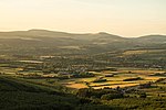
Foel Chwern
1977 archaeological discoveriesArchaeological sites in Neath Port TalbotBronze Age sites in WalesCairns (stone mounds)
Foel Chwern is a Round cairn on the edge of the high plateau east of the Neath valley, and near the summit of Craig y Llyn. The headwaters of the River Rhondda are to the south-west. It is a burial monument dating to the Bronze Age, and is sited on the edge of a steep scarp slope, with a wide field of view to the north. The long distance footpath Coed Morgannwg Way runs close by the cairn. Conifer plantations of the Rheola Forest surround the site.
Excerpt from the Wikipedia article Foel Chwern (License: CC BY-SA 3.0, Authors).Foel Chwern
Riding High,
Geographical coordinates (GPS) Address Nearby Places Show on map
Geographical coordinates (GPS)
| Latitude | Longitude |
|---|---|
| N 51.7228 ° | E -3.5962 ° |
Address
Riding High
Riding High
CF44 9HX , Blaengwrach
Wales, United Kingdom
Open on Google Maps


