place

Cutty Sark (pub)

Grade II listed buildings in the Royal Borough of GreenwichGrade II listed pubs in LondonPub stubsPubs in the Royal Borough of GreenwichUse British English from May 2014
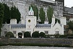
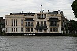
The Cutty Sark Tavern, Greenwich geograph.org.uk 1469975

The Cutty Sark is a Grade II listed public house at 6-7 Ballast Quay, Greenwich, London.It was built in the early 19th century, replacing an earlier pub, The Green Man. It was initially called The Union Tavern, but was renamed The Cutty Sark Tavern when the tea clipper came to Greenwich in 1951.The building comprises three storeys with widely spaced, Georgian bow windows.

Excerpt from the Wikipedia article Cutty Sark (pub) (License: CC BY-SA 3.0, Authors, Images).

Cutty Sark (pub)
Ballast Quay, London East Greenwich (Royal Borough of Greenwich)

Geographical coordinates (GPS) Address Nearby Places
placeShow on map

Wikipedia: Cutty Sark (pub)Continue reading on Wikipedia

Geographical coordinates (GPS)

Latitude Longitude
N 51.48631 ° E -0.00045 °
placeShow on map

Address

Ballast Quay 3
SE10 9PD London, East Greenwich (Royal Borough of Greenwich)
England, United Kingdom
mapOpen on Google Maps

The Cutty Sark Tavern, Greenwich geograph.org.uk 1469975
Share experience

Nearby Places

Queen's House
Queen's House

Queen's House is a former royal residence built between 1616 and 1635 near Greenwich Palace, a few miles down-river from the City of London and now in the London Borough of Greenwich. It presently forms a central focus of what is now the Old Royal Naval College with a grand vista leading to the River Thames. Its architect was Inigo Jones, for whom it was a crucial early commission, for Anne of Denmark, the queen of King James VI and I. Queen's House is one of the most important buildings in British architectural history, being the first consciously classical building to have been constructed in the country. It was Jones's first major commission after returning from his 1613–1615 grand tour of Roman, Renaissance, and Palladian architecture in Italy. Some earlier English buildings, such as Longleat and Burghley House, had made borrowings from the classical style, but these were restricted to small details not applied in a systematic way, or the building may be a mix of different styles. Furthermore, the form of these buildings was not informed by an understanding of classical precedents. Queen's House would have appeared revolutionary to English eyes in its day. Jones is credited with the introduction of Palladianism with the construction of Queen's House, although it diverges from the mathematical constraints of Palladio, and it is likely that the immediate precedent for the H-shaped plan straddling a road is the Villa Medici at Poggio a Caiano by Giuliano da Sangallo. Today the building is both a Grade I listed building and a scheduled monument, a status that includes the 115-foot-wide (35 m), axial vista to the River Thames. The house now forms part of the National Maritime Museum and is used to display parts of its substantial collection of maritime paintings and portraits.

Greenwich
Greenwich

Greenwich ( (listen) GREN-itch, GRIN-ij, GRIN-itch, or GREN-ij) is a town in south-east London, England, located in the historic county of Kent and the ceremonial county of Greater London. It is situated 5.5 miles (8.9 km) east-southeast of Charing Cross. Greenwich is notable for its maritime history and for giving its name to the Greenwich Meridian (0° longitude) and Greenwich Mean Time. The town became the site of a royal palace, the Palace of Placentia from the 15th century, and was the birthplace of many Tudors, including Henry VIII and Elizabeth I. The palace fell into disrepair during the English Civil War and was demolished to be replaced by the Royal Naval Hospital for Sailors, designed by Sir Christopher Wren and his assistant Nicholas Hawksmoor. These buildings became the Royal Naval College in 1873, and they remained a military education establishment until 1998 when they passed into the hands of the Greenwich Foundation. The historic rooms within these buildings remain open to the public; other buildings are used by University of Greenwich and Trinity Laban Conservatoire of Music and Dance. The town became a popular resort in the 18th century and many grand houses were built there, such as Vanbrugh Castle (1717) established on Maze Hill, next to the park. From the Georgian period estates of houses were constructed above the town centre. The maritime connections of Greenwich were celebrated in the 20th century, with the siting of the Cutty Sark and Gipsy Moth IV next to the river front, and the National Maritime Museum in the former buildings of the Royal Hospital School in 1934. Historically an ancient parish in the Blackheath Hundred of Kent, the town formed part of the growing conurbation of London in the 19th century. When the County of London, an administrative area designed to replace the Metropolitan Board of Works, was formed in 1889, the parish merged with those of Charlton-next-Woolwich, Deptford St Nicholas and Kidbrooke to create the Metropolitan Borough of Greenwich. When local government in London was again reformed in 1965, it merged with most of the Metropolitan Borough of Woolwich, creating what is now the Royal Borough of Greenwich, a local authority district of Greater London.

Maze Hill

Maze Hill is an area in Greenwich and Blackheath, in south-east London, lying to the east of Greenwich Park, and west of the Westcombe Park area of Blackheath. It is part of the Royal Borough of Greenwich, and takes its name from the main thoroughfare, Maze Hill. It gives its name to Maze Hill railway station. The road is believed to have taken its name from Sir Algernon May, who lived nearby until 1693, or after Robert May who lived there in 1683. 'Moys Hill' is marked on Rocque's 1745 map, 'Maize Hill' on Greenwood's 1827 map, and 'Maze Hill' on Bacon's map of 1888.While working as Surveyor to the Royal Hospital, the architect Sir John Vanbrugh lived (1719-1726) in a house of his own design, now known as Vanbrugh Castle, overlooking the park on what is now Maze Hill. Immediately to the north of Vanbrugh Castle was Mayfield Lodge, once used to print The Kentish Mercury, and from 1861 a Rescue Society for Females home (marked as ‘female reformatory’ on maps) which was demolished in 1906.The southern end of Maze Hill is adjacent to an area marked on Rocque's 1745 map as 'Vanbrugh Fields', with his name surviving in local street names including 'Vanbrugh Park' and 'Vanbrugh Hill'. Royal Ordnance Factories F.C. played some matches at Maze Hill. One of the two sites of the comprehensive secondary school, The John Roan School, is situated at the southern end of Maze Hill (the other is on Westcombe Park Road). Greenwich District Hospital (and its predecessor, St Alfege's Hospital) was sited at the northern end of Maze Hill until its closure in 2001 and demolition in 2006; the site is now occupied by a residential development surrounding a Royal Borough of Greenwich leisure centre, library and services complex. The southern part of Maze Hill (plus Westcombe Park) falls within the Blackheath Westcombe ward of the Royal Borough of Greenwich; the northern area of Maze Hill is in Peninsula Ward.