place

Chinatown, Adelaide

Adelaide stubsAsian-Australian culture in South AustraliaChinatowns in AustraliaCulture of AdelaideRestaurant districts and streets in Australia
Tourist attractions in AdelaideUse Australian English from January 2014
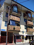
Adelaide Chinatown 2012

Chinatown in Adelaide, South Australia, Australia, also called Adelaide Chinatown or Moonta Street Chinatown, is located on Moonta Street, within the large Adelaide Central Markets precinct between Grote and Gouger streets in the Adelaide city centre. Two large Paifang, which were erected by the city council, are guarded by the Chinese guardian lions. They mark the entrances at either end. Adelaide Chinatown consists mainly of Chinese restaurants, grocery stores and markets but also consists of many non-Chinese Asian restaurants offering cuisines of Indian, Japanese, Korean, Malaysian, Nepali, Thai and Vietnamese origins.

Excerpt from the Wikipedia article Chinatown, Adelaide (License: CC BY-SA 3.0, Authors, Images).

Chinatown, Adelaide
Moonta Street, Adelaide Adelaide

Geographical coordinates (GPS) Address Nearby Places
placeShow on map

Wikipedia: Chinatown, AdelaideContinue reading on Wikipedia

Geographical coordinates (GPS)

Latitude Longitude
N -34.93 ° E 138.596 °
placeShow on map

Address

Commonwealth Bank

Moonta Street
5000 Adelaide, Adelaide
South Australia, Australia
mapOpen on Google Maps

Adelaide Chinatown 2012
Share experience

Nearby Places

Adelaide city centre

Adelaide city centre is the inner city locality of Greater Adelaide, the capital city of South Australia. It is known by locals simply as "the City" or "Town" to distinguish it from Greater Adelaide and from the City of Adelaide local government area (which also includes North Adelaide and from the Park Lands around the whole city centre). The population was 15,115 in the 2016 census. Adelaide city centre was planned in 1837 on a greenfield site following a grid layout, with streets running at right angles to each other. It covers an area of 4.33 square kilometres (1.67 square miles) and is surrounded by 6.68 square kilometres (2.58 square miles) of park lands. Within the city are five parks: Victoria Square in the exact centre and four other, smaller parks. Names for elements of the city centre are as follows: The "city square mile" (in reality 1.67 square miles or 4.33 square kilometres) is the constructed area bordered by North, East, South and West Terraces. The "central business district" (CBD) is an alternative term, but more accurately describes the intensively developed northern half of the city, which contains a multitude of commercial, cultural and entertainment premises, restaurants and high-rise apartments. The southern, lower-density half mainly contains small businesses, restaurants and, residentially, a mix of mansions, houses and conserved 19th century cottages, and (fewer) high-rise apartments. Precincts such as the West End and the East End have distinctive characters. CBD shopping precincts include Rundle Mall and Adelaide Central Market. In what is often described as the "North Terrace cultural precinct", many educational, cultural, entertainment and medical institutions lie between the northern side of North Terrace and the River Torrens – notably university campuses, the Adelaide Festival Centre, and the Parliament of South Australia. The Adelaide Railway Station is also located there.