Mynydd Allt-y-grug
Marilyns of WalesMountains and hills of Neath Port TalbotUse British English from August 2015

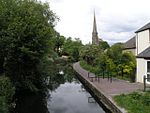
Mynydd Allt-y-grug is a 338-metre-high hill immediately west of Ystalyfera in the county borough of Neath Port Talbot in South Wales. Its twin summits are around 400m apart. The upper part of the hill is largely covered in heather whilst conifers clothe its western slopes and gorse, bracken and bramble cover much of its rough landslide eastern side which rises above the Swansea Valley, drainage on this side flowing to the River Tawe.
Excerpt from the Wikipedia article Mynydd Allt-y-grug (License: CC BY-SA 3.0, Authors, Images).Mynydd Allt-y-grug
Geographical coordinates (GPS) Address Nearby Places Show on map
Geographical coordinates (GPS)
| Latitude | Longitude |
|---|---|
| N 51.756 ° | E -3.811 ° |
Address
Ystalyfera
, Ystalyfera
Wales, United Kingdom
Open on Google Maps


