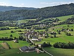
Col de Couz
Mountain passes of Auvergne-Rhône-AlpesMountain passes of the Alps

The Col de Couz is a pass located near the village of Saint-Jean-de-Couz, peaking at 624 m above sea level. It is located at equal distances from the ends of the valley of Couz. It connects Chambéry north-east to Les Echelles southwest side. It is crossed by the departmental road 1006. Mount Beauvoir is located west of the Col de Couz.
Excerpt from the Wikipedia article Col de Couz (License: CC BY-SA 3.0, Authors, Images).Col de Couz
D 45, Chambéry
Geographical coordinates (GPS) Address Nearby Places Show on map
Geographical coordinates (GPS)
| Latitude | Longitude |
|---|---|
| N 45.469166666667 ° | E 5.8172222222222 ° |
Address
D 45
73160 Chambéry
Auvergne-Rhône-Alpes, France
Open on Google Maps


