place

Santa Monica Mountains

Archaeological sites in CaliforniaGeography of the San Fernando ValleyMalibu, CaliforniaMountain ranges of Los Angeles County, CaliforniaMountain ranges of Southern California
Mountain ranges of Ventura County, CaliforniaSanta Monica MountainsTransverse RangesUse mdy dates from November 2018
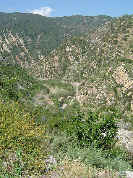
Santa monica mountains canyon

The Santa Monica Mountains is a coastal mountain range in Southern California, next to the Pacific Ocean. It is part of the Transverse Ranges. The Santa Monica Mountains National Recreation Area encompasses this mountain range. Because of its proximity to densely populated regions, it is one of the most visited natural areas in California.

Excerpt from the Wikipedia article Santa Monica Mountains (License: CC BY-SA 3.0, Authors, Images).

Santa Monica Mountains
Sandstone Peak Trail,

Geographical coordinates (GPS) Address Nearby Places
placeShow on map

Wikipedia: Santa Monica MountainsContinue reading on Wikipedia

Geographical coordinates (GPS)

Latitude Longitude
N 34.120284166667 ° E -118.93176333333 °
placeShow on map

Address

Sandstone Peak Trail

California, United States
mapOpen on Google Maps

Santa monica mountains canyon
Share experience

Nearby Places

Boney Peak
Boney Peak

Boney Mountain in Ventura County, California is one of the highest peaks in the Santa Monica Mountains. The prominent mountain visible from Newbury Park, California is 2,825 feet (861 m). It is also known as Boney Peak. The mountain contains four of the highest peaks in the coastal range of the Santa Monica Mountains: Boney Peak, Sandstone Peak, Exchange Peak, and Tri Peaks. The highest summit in the Santa Monica Mountains is Sandstone Peak (Mount Allen), situated less than a mile northeast of Boney Peak along the same ridge of volcanic rock. It is the top section of a mass of volcanic rock which solidified around 15 million years ago, and was later uplifted to its dominant position, overshadowing western Conejo Valley. The Chumash Native Americans have a long and deeply spiritual history of interaction at and near the mountain, and the peak is considered a sacred mountain to the Chumash people.It is located in the Circle X Ranch Park, within the Santa Monica Mountains National Recreation Area. The surrounding Boney Mountain State Wilderness Area lies within the eastern portion of Point Mugu State Park. Boney Mountain State Wilderness includes trail access to the rest of Point Mugu State Park, as well as Big Sycamore Canyon and Rancho Sierra Vista/Satwiwa Native American Indian Culture Center. Hiking trails from Satwiwa Native American Cultural Center in southernmost Newbury Park reach Boney Mountain and Peak, and feature views of the Pacific Ocean, Channel Islands, and Mount Baldy. Nearby trails lead to Danielson Monument and the Sycamore Canyon Waterfall. Boney Mountain was described by Chumash Indians to anthropologist John P. Harrington around year 1900: Early one morning in 9080 B.C., the ancestral grandfather from whom I took my name, headed west on one of his most adventurous hunting trips ever... As the group climbed Old Boney, they looked back to the north and could see the pleasant openings of the Conejo- and Hidden Valleys. There, there appeared to be good grazing ground for the mammoth herd and they proceeded thence. The story may be a lore related to the Paleo-Indians, the distant ancestors of the Chumash. An ancient Chumash village known as Satwiwa was located at the foothills of the mountain, which remains sacred to the Chumash people. Satwiwa is believed to be first inhabited 13,000 years ago, and was still a Chumash inhabitation site as of 2,000 years ago.In 2019, newspaper photos showed the peak was frosted with snow. Long time Newbury Park residents said it was the first time they had seen snow on the peak.

Deer Ridge Open Space

Deer Ridge Open Space is a 188-acre public-owned open-space area in the southwest portion of the town of Newbury Park, California. It contains a series of north-facing mountainous ridges and canyons, dominated by chaparral and oak trees. It shares borders with the Santa Monica Mountains National Recreation Area to the south, and the Los Robles Trail traverses the length of Deer Ridge Open Space. Its main trailhead is located on Potrero Road, while a smaller access point is located at the southern end of Felton Street. The Los Robles Trail is the Conejo Open Space Conservation Agency’s longest trail, and connects to open-space areas and parks such as the Los Padres Open Space, Conejo Ridge Open Space, Hope Nature Preserve, Old Conejo Open Space, and the Los Vientos Open Space. The trail in Newbury Park provides panoramic views of the Conejo Valley and Santa Monica Mountains, before entering the Hope Nature Preserve. The Los Robles Trail provides more than 25 miles of contiguous trails connecting Newbury Park to Westlake Village in Los Angeles County. Immediately south of the Deer Ridge Open Space in Newbury Park are the Hidden Valley and Rancho Sierra Vista Satwiwa.The trails are utilized by hikers, mountain bikers, equestrians, and for jogging or running. It is part of a Southern California wildlife corridor that also links through trails to the Point Mugu State Park and the oceanfront Santa Monica Mountains. Some of the fauna includes the American black bear, Mountain lion, Coyote, Grey fox, Mule deer, Bobcat, Southern Pacific Rattlesnake, Stripe-tailed scorpion, and much more. The flora consists of various Chaparral, Coastal sage scrub, and pockets of oak woodlands. The Los Robles Trail is the main trail in the Deer Ridge Open Space and follows the east-west ridge to the Hope Nature Preserve, and beyond to Thousand Oaks, CA. The trail provides panoramic views of the Santa Monica Mountains to the right, while the high elevation makes for great overlooks of Newbury Park on the left side of the trail. It leads to the 1,600-foot high Angel Vista in the Ventu Park Open Space after transversing the Deer Ridge in southern Newbury Park.To get here from the Ventura Freeway (U.S. 101), exit at Wendy Drive and head south towards the Santa Monica Mountains. When the road ends in front of the trailheads to the Santa Monica Mountains National Recreation Area on the opposite side of the intersection, make a left on Potrero Road and follow the road for 0.5 miles until the trailhead parking lot appears on the left side of the street.