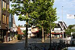
Boekel, North Holland
North Holland geography stubsPopulated places in North Holland

Boekel is a hamlet in the Dutch province of North Holland. It is a part of the municipality of Castricum, and lies about 5 km south of Alkmaar. Until January 1, 2002, Boekel belonged to the municipality of Akersloot. It had a population of about 10 in 2001.Boekel is located on the west bank of the Noordhollandsch Kanaal. According to the 19th-century historian A.J. van der Aa, a castle was located here, also called "Boekel". It was destroyed by the Spanish army during the siege of Alkmaar, on October 3, 1574.
Excerpt from the Wikipedia article Boekel, North Holland (License: CC BY-SA 3.0, Authors, Images).Boekel, North Holland
Boekel,
Geographical coordinates (GPS) Address Nearby Places Show on map
Geographical coordinates (GPS)
| Latitude | Longitude |
|---|---|
| N 52.59 ° | E 4.7533333333333 ° |
Address
Boekel 35f
1921 CE
North Holland, Netherlands
Open on Google Maps


