Egham

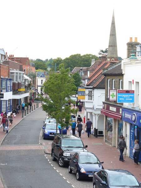
Egham ( EG-əm) is a town in the Borough of Runnymede in Surrey, England, approximately 19 miles (31 km) west of central London. First settled in the Bronze Age, the town was under the control of Chertsey Abbey for much of the Middle Ages. In 1215, Magna Carta was sealed by King John at Runnymede, to the north of Egham, having been chosen for its proximity to the King's residence at Windsor. Under the Dissolution of the Monasteries in the early 16th Century, the major, formerly ecclesiastical, manorial freehold interests in the town and various market revenues passed to the Crown.In the 17th and 18th centuries, Egham became a stop on coaching routes between London and many places to the west. The importance of this shrank from the building of the Western and South Western Railways but was for many decades offset by the stark growth in the population of London and the country at large. Egham station was opened in 1856 on the line from Waterloo to Reading and services are operated today by South Western Railway. The town is west of the M25 motorway, accessible via junction 13. The campus of Royal Holloway, University of London is 1 mile (2 km) to the west of Egham town centre, close to Englefield Green.
Excerpt from the Wikipedia article Egham (License: CC BY-SA 3.0, Authors, Images).Egham
Rusham Road, Borough of Runnymede
Geographical coordinates (GPS) Address Nearby Places Show on map
Geographical coordinates (GPS)
| Latitude | Longitude |
|---|---|
| N 51.429 ° | E -0.548 ° |
Address
Rusham Road 3a
TW20 9LS Borough of Runnymede
England, United Kingdom
Open on Google Maps


