place

Third Czechoslovak Republic

1918 establishments in Europe1938 disestablishments in Europe1940s in Czechoslovakia1945 establishments in Czechoslovakia1948 disestablishments in Czechoslovakia
All pages needing cleanupFormer countries of the Cold WarFormer republicsHistory of CzechoslovakiaPolitical history of CzechoslovakiaStates and territories disestablished in 1948States and territories established in 1945Wikipedia introduction cleanup from June 2020
Flag of the Czech Republic

During World War II, Czechoslovakia had largely disappeared from the map of Europe. The Third Czechoslovak Republic (Czech: Třetí Československá republika, Slovak: Tretia česko-slovenská republika) which emerged as a sovereign state after the end of the war was not only the result of the policies of the victorious Western allies, the French Fourth Republic, the United Kingdom and the United States, but also an indication of the strength of the Czechoslovak ideal embodied in the First Czechoslovak Republic. However, at the conclusion of World War II, Czechoslovakia fell within the Soviet sphere of influence, and this circumstance dominated any plans or strategies for postwar reconstruction. Consequently, the political and economic organisation of Czechoslovakia became largely a matter of negotiations between Edvard Beneš and Communist Party of Czechoslovakia (KSČ) exiles living in Moscow. In February 1948, the Communist Party of Czechoslovakia seized full power in a coup d'état. Despite the country's official name remaining the Czechoslovak Republic until 1960, when it was changed to the Czechoslovak Socialist Republic, February 1948 is considered the end of the Third Republic.

Excerpt from the Wikipedia article Third Czechoslovak Republic (License: CC BY-SA 3.0, Authors, Images).

Third Czechoslovak Republic
Olšanská, Prague Žižkov

Geographical coordinates (GPS) Address Nearby Places
placeShow on map

Wikipedia: Third Czechoslovak RepublicContinue reading on Wikipedia

Geographical coordinates (GPS)

Latitude Longitude
N 50.0833 ° E 14.4667 °
placeShow on map

Address

Residence Garden Towers

Olšanská
130 00 Prague, Žižkov
Prague, Czechia
mapOpen on Google Maps

Flag of the Czech Republic
Share experience

Nearby Places

Nové spojení
Nové spojení

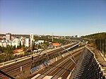
The Nové spojení (Czech for "New Connection", full name Nové spojení Praha hl.n., Masarykovo n. – Libeň, Vysočany, Holešovice) is a series of tunnels and bridges forming an important part of the railway network in Prague, Czech Republic. The network was constructed between 2004 and 2008 and opened in 2010. It links the two central stations, Praha hlavní and Praha Masarykovo, to Libeň, Vysočany and Holešovice stations and the start of their respective mainline corridors towards Česká Třebová, Hradec Králové and Ústí nad Labem. The construction has increased the capacity of the trunk lines serving Praha hlavní nádraží, allowing more trains to terminate there. Prior to its completion, many international trains terminated at Holešovice station, due to lack of access to the centre from the northern and eastern routes. Trains are now also able to travel at speeds of up to 100 kilometres per hour (62 mph) on the tunnel sections. The construction is also part of a larger plan to improve the sections of pan-European corridors on Czech territory.After leaving both central stations, the electrified tracks lead through a 1.3 km-long tunnel under Vítkov hill in Žižkov, then over a series of bridges skirting the Žižkov-Libeň border leading to a large junction at Balabenka. From here, trains continue east to Vysočany and Libeň, and turn north to Holešovice station, making use of the previously existing tracks which lead to Holešovice from Libeň. The construction of Nové spojení also led to numerous improvements in road infrastructure, including a heated overbridge at Krejcárek, which replaced a level crossing.