Truxton Circle

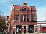
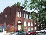
Truxton Circle is a neighborhood of Northwest Washington, D.C. Politically, it is located in Ward 5. Truxton Circle is bordered by New Jersey Avenue to the west; Florida Avenue to the north; New York Avenue to the south; and North Capitol Street to the east. It is bordered By the following neighborhoods: to the north by Bloomingdale and LeDroit Park; to the east by Eckington; to the west by Shaw and Mt. Vernon Square Historic District; and to the south by NoMa. Truxton Circle is named for the former Thomas Truxtun traffic circle, which was located at the intersection of North Capitol Street and Florida Avenue and which was demolished in 1947. It was part of the Shaw School Urban Renewal Area, later known as the Shaw neighborhood.
Excerpt from the Wikipedia article Truxton Circle (License: CC BY-SA 3.0, Authors, Images).Truxton Circle
North Capitol Street Northeast, Washington
Geographical coordinates (GPS) Address Nearby Places Show on map
Geographical coordinates (GPS)
| Latitude | Longitude |
|---|---|
| N 38.911056 ° | E -77.008972 ° |
Address
North Capitol Street Northeast
North Capitol Street Northeast
20554 Washington
District of Columbia, United States
Open on Google Maps


