Loftus, North Yorkshire
Civil parishes in North YorkshireLoftus, North YorkshirePlaces in the Tees ValleyRedcar and ClevelandTowns in North Yorkshire ... and 1 more
Use British English from October 2021

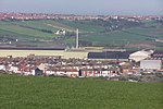
Loftus is a market town and civil parish in the Redcar and Cleveland borough of North Yorkshire, England. The town is located north of the North York Moors and sits between Whitby and Skelton-in-Cleveland. At the 2011 census, the town's parish population was 7,988. The parish includes the villages of Carlin How, Easington, Liverton, Liverton Mines and Skinningrove. The town was formerly known as Lofthouse. The town's built-up area, including Liverton Mines, had a population of 4,824. It is near Brotton, Saltburn and Skelton-in-Cleveland.
Excerpt from the Wikipedia article Loftus, North Yorkshire (License: CC BY-SA 3.0, Authors, Images).Loftus, North Yorkshire
Queens Road,
Geographical coordinates (GPS) Address Nearby Places Show on map
Geographical coordinates (GPS)
| Latitude | Longitude |
|---|---|
| N 54.5569 ° | E -0.8919 ° |
Address
Queens Road
Queens Road
TS13 4SQ
England, United Kingdom
Open on Google Maps


