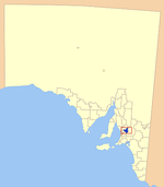
Electoral district of Angas
1938 establishments in Australia1970 disestablishments in AustraliaConstituencies disestablished in 1970Constituencies established in 1938Former electoral districts of South Australia
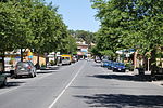
Angas was an electoral district of the House of Assembly in the Australian state of South Australia from 1938 to 1970 and which was associated with the town of Angaston.
Excerpt from the Wikipedia article Electoral district of Angas (License: CC BY-SA 3.0, Authors).Electoral district of Angas
Johnson Lane, The Barossa Council
Geographical coordinates (GPS) Address Nearby Places Show on map
Geographical coordinates (GPS)
| Latitude | Longitude |
|---|---|
| N -34.5015 ° | E 139.04625 ° |
Address
Johnson Lane
5353 The Barossa Council
South Australia, Australia
Open on Google Maps


